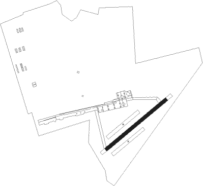
Kasumigaura-shi - Kasumigaura Ab
Airport details
| Country | Japan |
| State | Ibaraki Prefecture |
| Region | RJ |
| Airspace | Fukuoka Ctr |
| Municipality | Ami |
| Elevation | 83ft (25m) |
| Timezone | GMT +9 |
| Coordinates | 36.03463, 140.19208 |
| Magnetic var | |
| Type | land |
| Available since | X-Plane v10.40 |
| ICAO code | RJAK |
| IATA code | n/a |
| FAA code | n/a |
Communication
Nearby Points of Interest:
Hitachi Kokubunji
-Ryūgakuji Kofun Cluster
-Bernard Leach
-Yokotone Lock
-Former Hananoi Family House
-historic streets of Sawara
-Wisteria in Ushijima
-Tojō-tei
-Yamamoto-tei
-Yatsu-higata
-Yōgō no Matsu
-Former Tobita Family Residence
-Minuma Tsūsen-bori
-Shirahige Bridge
-Former Tanaka Family Residence
-Mikawashima Water Reclamation Center
-Kogane Ichirizuka
-Old Iwabuchi Sluice Gates
-Kototoi Bridge
-Mikazuki Munechika
-Writing Box with Eight Bridges
-Suda Hachiman Shrine Mirror
-Pine Trees
-International Library of Children's Literature
-Kuromon
Nearby beacons
| code | identifier | dist | bearing | frequency |
|---|---|---|---|---|
| TLD | DME | 1 | 135° | 116 |
| SND | (TOKYO) DME | 11.8 | 245° | 114 |
| HUC | HYAKURI VORTAC | 14.1 | 55° | 113.30 |
| SHT | SHIMOFUSA (MATSUDO) TACAN | 16.5 | 218° | 108.20 |
| NRE | NARITA (TOKYO) VOR/DME | 17.2 | 146° | 117.90 |
| SYE | SEKIYADO VOR/DME | 17.2 | 266° | 117 |
| JD | NIKKO (UTSUNOMIYA) NDB | 31.5 | 324° | 389 |
| JDT | UTSUNOMIYA TACAN | 32.7 | 327° | 112.15 |
| CVT | CHOSHI TACAN | 34.8 | 117° | 113.60 |
| HME | HANEDA (TOKYO) VOR/DME | 35.2 | 222° | 112.20 |
| YLT | IRUMA TACAN | 39.5 | 256° | 110.60 |
| KZT | KISARAZU TACAN | 40.7 | 204° | 110.05 |
| TN | SHIN-TACHIKAWA NDB | 42.9 | 248° | 366 |
| TNT | TACHIKAWA TACAN | 43 | 248° | 115.80 |
| GOT | DAIGO TACAN | 43.3 | 13° | 115.30 |
| YOK | YOKOTA (TOKYO) TACAN | 44.4 | 251° | 113.80 |
| NJA | ATSUGI TACAN | 50.4 | 231° | 115.10 |
| OJT | ONJUKU TACAN | 51.8 | 168° | 115.70 |
| HYD | DME | 55.3 | 218° | 116.20 |
Disclaimer
The information on this website is not for real aviation. Use this data with the X-Plane flight simulator only! Data taken with kind consent from X-Plane 12 source code and data files. Content is subject to change without notice.
