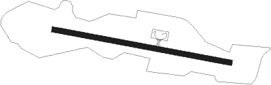
Kozushima
Airport details
| Country | Japan |
| State | Tōkyō Prefecture |
| Region | RJ |
| Airspace | Fukuoka Ctr |
| Municipality | Tokyo |
| Elevation | 454ft (138m) |
| Timezone | GMT +9 |
| Coordinates | 34.18945, 139.13361 |
| Magnetic var | |
| Type | land |
| Available since | X-Plane v10.40 |
| ICAO code | RJAZ |
| IATA code | n/a |
| FAA code | n/a |
Communication
| Kozushima Izu Remote | 124.300 |
Nearby beacons
| code | identifier | dist | bearing | frequency |
|---|---|---|---|---|
| NJT | NIIJIMA TACAN | 11.7 | 41° | 116.50 |
| MOE | OYAMA VOR/DME | 22.4 | 105° | 108.65 |
| XAC | OSHIMA VORTAC | 34.3 | 28° | 113.10 |
| OSE | MIHARA (OSHIMA) VOR/DME | 37.7 | 21° | 109.85 |
| YZT | SHIZUHAMA (YAIZU) TACAN | 55.9 | 307° | 109.20 |
| TET | TATEYAMA TACAN | 58.4 | 42° | 108.80 |
| PQD | DME | 59 | 45° | 112.50 |
| SZE | SHIZUOKA VOR/DME | 59.1 | 303° | 110.65 |
Departure and arrival routes
| Transition altitude | 14000ft |
| Transition level | 14000ft |
| SID end points | distance | outbound heading | |
|---|---|---|---|
| RW11 | |||
| KOZU1 | 34mi | 28° | |
| RW29 | |||
| KOZU1 | 34mi | 28° | |
Instrument approach procedures
| runway | airway (heading) | route (dist, bearing) |
|---|---|---|
| RW11 | KOUGA (221°) | KOUGA 5000ft SENOL (12mi, 270°) AZ150 (6mi, 215°) ONBAS (5mi, 116°) 1856ft |
| RNAV | ONBAS 1856ft AZ151 (3mi, 116°) 895ft AZ152 (5mi, 115°) KOUGA (12mi, 21°) 5000ft KOUGA (turn) | |
| RW29 | KOUGA (221°) | KOUGA 5000ft TENJO (5mi, 141°) AZ950 (6mi, 180°) TAKOU (5mi, 270°) 1890ft |
| RNAV | TAKOU 1890ft AZ951 (3mi, 270°) 929ft AZ952 (4mi, 270°) KOUGA (14mi, 50°) 5000ft KOUGA (turn) |
Disclaimer
The information on this website is not for real aviation. Use this data with the X-Plane flight simulator only! Data taken with kind consent from X-Plane 12 source code and data files. Content is subject to change without notice.