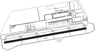
Kobe
Airport details
| Country | Japan |
| State | Hyōgo Prefecture |
| Region | RJ |
| Airspace | Fukuoka Ctr |
| Municipality | Kobe |
| Elevation | 20ft (6m) |
| Timezone | GMT +9 |
| Coordinates | 34.63536, 135.22008 |
| Magnetic var | |
| Type | land |
| Available since | X-Plane v10.40 |
| ICAO code | RJBE |
| IATA code | UKB |
| FAA code | n/a |
Communication
| Kobe KOBE ATIS | 128.075 |
| Kobe KOBE TOWER | 118.500 |
| Kobe KOBE DepartureARTURE | 118.500 |
Approach frequencies
| ILS-cat-I | RW09 | 109.15 | 18.00mi |
| 3° GS | RW09 | 109.15 | 18.00mi |
Nearby Points of Interest:
Minato Ijinkan
-Shinkō Trade Hall
-Chartered Building
-Kaigan Building
-Former Foreign Settlement Building No. 15
-Hyogo Prefecture Guest House
-Kitano Monogatarikan
-Kitano-chō and Yamamoto-dōri
-Futatabi Park
-Yodokō Guest House
-Otaue Shinto Service
-Sumiyoshi Angū
-Dogameyama Kofun
-Mozu kofungun
-Nankai Building
-Osaka Gas Building
-Shibakawa Building
-Mengyo Kaikan
-Tekijuku
-Osaka Prefectural Nakanoshima Library
-Harima Shop
-Former Konishi Family Residence
-Kitahama Retro Building
Nearby beacons
| code | identifier | dist | bearing | frequency |
|---|---|---|---|---|
| KCE | KOBE VOR/DME | 0.4 | 118° | 111.25 |
| KIE | KANSAI VOR/DME | 12.6 | 183° | 111.60 |
| ITE | ITAMI VOR/DME | 13.6 | 47° | 114.75 |
| YOE | YAO VOR/DME | 18.5 | 96° | 114.60 |
| AJD | DME | 33.3 | 234° | 115.60 |
| TSC | TOKUSHIMA VORTAC | 42.9 | 230° | 114.90 |
| TS | TOKUSHIMA NDB | 43 | 230° | 332 |
| GBD | DME | 43.9 | 189° | 116.90 |
| STD | DME | 47.3 | 263° | 114.40 |
| KJT | KOMATSUSHIMA TACAN | 48 | 223° | 113.55 |
| YME | MIYAZU VOR/DME | 50.9 | 354° | 112.60 |
| NKE | NANKI VOR/DME | 58.9 | 172° | 109.05 |
Departure and arrival routes
| Transition altitude | 14000ft |
| Transition level | 14000ft |
| SID end points | distance | outbound heading | |
|---|---|---|---|
| RW09 | |||
| KCE5 | 51mi | 354° | |
| RW27 | |||
| KCE5 | 51mi | 354° | |
| STAR starting points | distance | inbound heading | |
|---|---|---|---|
| ALL | |||
| TSC | 42.8 | 50° | |
| AYAYA | 34.4 | 100° | |
| RW09 | |||
| HANSHS | 55.6 | 45° | |
| HANSHW | 53.3 | 62° | |
| HANSHN | 22.6 | 94° | |
Holding patterns
| STAR name | hold at | type | turn | heading* | altitude | leg | speed limit |
|---|---|---|---|---|---|---|---|
| AYAYA | SIOJI | VHF | left | 273 (93)° | > 3000ft | DME 6.1mi | 230 |
| AYAYA | TRACY | VHF | left | 311 (131)° | 3000ft - 60000ft | DME 4.8mi | 230 |
| HANSHN | SIOJI | VHF | left | 273 (93)° | > 3000ft | DME 6.1mi | 230 |
| HANSHN | TRACY | VHF | left | 311 (131)° | 3000ft - 60000ft | DME 4.8mi | 230 |
| HANSHS | SIOJI | VHF | left | 273 (93)° | > 3000ft | DME 6.1mi | 230 |
| HANSHS | TRACY | VHF | left | 311 (131)° | 3000ft - 60000ft | DME 4.8mi | 230 |
| HANSHW | SIOJI | VHF | left | 273 (93)° | > 3000ft | DME 6.1mi | 230 |
| HANSHW | TRACY | VHF | left | 311 (131)° | 3000ft - 60000ft | DME 4.8mi | 230 |
| TSC | SIOJI | VHF | left | 273 (93)° | > 3000ft | DME 6.1mi | 230 |
| TSC | TRACY | VHF | left | 311 (131)° | 3000ft - 60000ft | DME 4.8mi | 230 |
| *) magnetic outbound (inbound) holding course | |||||||
Disclaimer
The information on this website is not for real aviation. Use this data with the X-Plane flight simulator only! Data taken with kind consent from X-Plane 12 source code and data files. Content is subject to change without notice.
