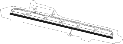
Hakodate
Airport details
| Country | Japan |
| State | Hokkaidō Prefecture |
| Region | RJ |
| Airspace | Fukuoka Ctr |
| Municipality | Hakodate |
| Elevation | 110ft (34m) |
| Timezone | GMT +9 |
| Coordinates | 41.77000, 140.82195 |
| Magnetic var | |
| Type | land |
| Available since | X-Plane v10.40 |
| ICAO code | RJCH |
| IATA code | HKD |
| FAA code | n/a |
Communication
| Hakodate ATIS | 126.600 |
| Hakodate Tower | 126.200 |
| Hakodate Tower | 118.350 |
| Hakodate Approach | 121.000 |
| Hakodate Approach | 119.000 |
| Hakodate Departure | 121.000 |
| Hakodate Departure | 127.900 |
Approach frequencies
| ILS-cat-I | RW12 | 109.3 | 18.00mi |
| 3° GS | RW12 | 109.3 | 18.00mi |
Nearby Points of Interest:
Shinoridate
-Kōsetsu-en
-Hollow Dogū
-Fort Hakodate Ruins
-Kakinoshima Site
-Ōnuma
Nearby beacons
| code | identifier | dist | bearing | frequency |
|---|---|---|---|---|
| HWE | HAKODATE VOR/DME | 0.5 | 69° | 112.30 |
| OMT | OMINATO TACAN | 35.3 | 150° | 114.85 |
| CHE | CHITOSE VOR/DME | 67.7 | 43° | 116.90 |
| ZYT | CHITOSE (SAPPORO) TACAN | 70.7 | 41° | 109.20 |
Departure and arrival routes
| Transition altitude | 14000ft |
| Transition level | 14000ft |
| SID end points | distance | outbound heading | |
|---|---|---|---|
| RW12 | |||
| TIKYU1 | 17mi | 104° | |
| HWE7S | 62mi | 186° | |
| TSUGA1, TAPPI7 | 132mi | 196° | |
| ESASI6 | 30mi | 283° | |
| RW30 | |||
| TIKYU1 | 17mi | 104° | |
| HWE7S | 62mi | 186° | |
| TAPPI7, TSUGA1 | 132mi | 196° | |
| ESASI6 | 30mi | 283° | |
| STAR starting points | distance | inbound heading | |
|---|---|---|---|
| RW12 | |||
| PATRA | 19.7 | 5° | |
| RW30 | |||
| YAKEI | 19.7 | 5° | |
Instrument approach procedures
| runway | airway (heading) | route (dist, bearing) |
|---|---|---|
| RW12 | TAXIR (5°) | TAXIR 4000ft BOHNI (10mi, 335°) 2500ft YUNOK (6mi, 335°) 2500ft |
| RNAV | YUNOK 2500ft CH271 (3mi, 335°) 2500ft BESAR (2mi, 7°) 2500ft CH272 (3mi, 74°) 1421ft RJCH (5mi, 104°) 143ft CH273 (5mi, 104°) TAXIR (19mi, 203°) 4000ft TAXIR (turn) 4000ft | |
| RW30-Y | TAXIR (5°) | TAXIR 4000ft SABIO (10mi, 25°) 2500ft |
| RNAV | SABIO 2500ft TRAPI (5mi, 25°) 2500ft CH054 (1mi, 25°) 2041ft CH055 (4mi, 327°) 774ft RJCH (3mi, 284°) 201ft CH272 (5mi, 284°) CH056 (5mi, 231°) TAXIR (19mi, 152°) 4000ft TAXIR (turn) 4000ft | |
| RW30-Z | CHIYO (273°) | CHIYO 3500ft ROCCA (5mi, 215°) 2500ft |
| RW30-Z | YAKEI (312°) | YAKEI 4000ft ROCCA (5mi, 35°) 2500ft |
| RNAV | ROCCA 2500ft IKARU (5mi, 292°) 2033ft CH058 (2mi, 292°) 1524ft CH059 (2mi, 292°) 1014ft CH060 (2mi, 292°) 440ft (7528mi, 253°) 620ft TAXIR (7538mi, 74°) 4000ft TAXIR (turn) 4000ft |
Holding patterns
| STAR name | hold at | type | turn | heading* | altitude | leg | speed limit |
|---|---|---|---|---|---|---|---|
| PATRA | TAXIR | VHF | left | 194 (14)° | > 4000ft | DME 6.0mi | 230 |
| YAKEI | TAXIR | VHF | left | 194 (14)° | > 4000ft | DME 6.0mi | 230 |
| *) magnetic outbound (inbound) holding course | |||||||
Disclaimer
The information on this website is not for real aviation. Use this data with the X-Plane flight simulator only! Data taken with kind consent from X-Plane 12 source code and data files. Content is subject to change without notice.
