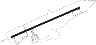
Nakashibetsu
Airport details
| Country | Japan |
| State | Hokkaidō Prefecture |
| Region | RJ |
| Airspace | Fukuoka Ctr |
| Municipality | Nakashibetsu |
| Elevation | 213ft (65m) |
| Timezone | GMT +9 |
| Coordinates | 43.57750, 144.96001 |
| Magnetic var | |
| Type | land |
| Available since | X-Plane v10.40 |
| ICAO code | RJCN |
| IATA code | SHB |
| FAA code | n/a |
Communication
| Nakashibetsu Nakashibetsu Remote | 122.700 |
| Nakashibetsu Sapporo Control | 128.325 |
| Nakashibetsu Sapporo Control | 134.250 |
Approach frequencies
| ILS-cat-I | RW08 | 109.35 | 18.00mi |
| 3° GS | RW08 | 109.35 | 18.00mi |
Nearby Points of Interest:
Notsuke Bay
-Notsuke Peninsula
-Lake Mashū
-Shiretoko Peninsula
Runway info
| Runway 08 / 26 | ||
| length | 1997m (6552ft) | |
| bearing | 76° / 256° | |
| width | 45m (146ft) | |
| surface | asphalt | |
| blast zone | 61m (200ft) / 61m (200ft) | |
Nearby beacons
| code | identifier | dist | bearing | frequency |
|---|---|---|---|---|
| NSE | NAKASHIBETSU VOR/DME | 0.4 | 269° | 111.45 |
| BF | MENDELEYEVO (YUZHNO-KURILSK) NDB | 37.1 | 65° | 525 |
| B | MENDELEYEVO (YUZHNO-KURILSK) NDB | 38.3 | 63° | 255 |
| MNW | MENDELEYEVO VOR/DME | 38.4 | 63° | 114.50 |
| TBE | MEMANBETSU VOR/DME | 39 | 291° | 110.85 |
| KSE | KUSHIRO VOR/DME | 46.4 | 234° | 112.50 |
Departure and arrival routes
| Transition altitude | 14000ft |
| Transition level | 14000ft |
| SID end points | distance | outbound heading | |
|---|---|---|---|
| RW08 | |||
| KIRIT1, TSURU1 | 46mi | 234° | |
| MASHU5 | 19mi | 256° | |
| RW26 | |||
| KIRIT1, TSURU1 | 46mi | 234° | |
| MASHU5 | 19mi | 256° | |
| STAR starting points | distance | inbound heading | |
|---|---|---|---|
| ALL | |||
| KSE | 46.4 | 54° | |
Instrument approach procedures
| runway | airway (heading) | route (dist, bearing) |
|---|---|---|
| RW26-Y | OMOTI (342°) | OMOTI 5000ft YUKIM (11mi, 35°) 5000ft DIFUK (8mi, 339°) 5000ft |
| RNAV | DIFUK 5000ft CN671 (10mi, 331°) 2500ft CN670 (2mi, 331°) 1994ft CN650 (3mi, 288°) 783ft RJCN (2mi, 256°) 262ft RJCN (turn) 700ft DIFUK (15mi, 132°) 5000ft DIFUK (turn) 5000ft | |
| RW26-Z | MASHU (76°) | MASHU 5000ft MILKU (18mi, 86°) 3700ft |
| RNAV | MILKU 3700ft CN661 (4mi, 87°) 3700ft CN650 (5mi, 344°) 783ft RJCN (2mi, 256°) 262ft MASHU (19mi, 256°) 5000ft MASHU (turn) 5000ft |
Disclaimer
The information on this website is not for real aviation. Use this data with the X-Plane flight simulator only! Data taken with kind consent from X-Plane 12 source code and data files. Content is subject to change without notice.
