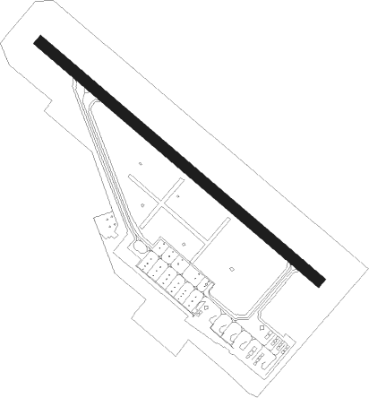
Sapporo - Saporro Okadama
Airport details
| Country | Japan |
| State | Hokkaidō Prefecture |
| Region | RJ |
| Airspace | Fukuoka Ctr |
| Municipality | Sapporo |
| Elevation | 26ft (8m) |
| Timezone | GMT +9 |
| Coordinates | 43.11750, 141.38139 |
| Magnetic var | |
| Type | land |
| Available since | X-Plane v10.40 |
| ICAO code | RJCO |
| IATA code | OKD |
| FAA code | n/a |
Communication
| Saporro Okadama Ground Control | 121.800 |
| Saporro Okadama Tower | 126.200 |
Nearby Points of Interest:
Sapporo Agricultural College Farm No. 2
-Furukawa Hall
-Sapporo Agricultural College Entomology and Sericulture Hall
-Hokkaido University Botanical Gardens
-Former Hokkaidō Government Office
-Sōsei Bridge
-Batchelor Memorial Building
-Hokkaido Governor's Official Residence
-Former Hokkaido Bank Head Office
-Kiusu Earthwork Burial Circles
-Yoichi distillery
Nearby beacons
| code | identifier | dist | bearing | frequency |
|---|---|---|---|---|
| SPE | SAPPORO VOR/DME | 4.8 | 306° | 113.90 |
| ZYT | CHITOSE (SAPPORO) TACAN | 24.7 | 140° | 109.20 |
| CHE | CHITOSE VOR/DME | 28.4 | 144° | 116.90 |
| MKE | MUKAWA (SAPPORO) VOR/DME | 42.1 | 134° | 116.40 |
Departure and arrival routes
| Transition altitude | 14000ft |
| Transition level | 14000ft |
| SID end points | distance | outbound heading | |
|---|---|---|---|
| RW14 | |||
| TOBE1N, SPE3 | 38mi | 31° | |
| KURIS3, KURI4R, TOBE1E | 14mi | 83° | |
| BANKE1 | 13mi | 221° | |
| RW32 | |||
| SPE3, TOBE1N | 38mi | 31° | |
| KURIS3, TOBE1E, KURI4R | 14mi | 83° | |
| BANKE1 | 13mi | 221° | |
| STAR starting points | distance | inbound heading | |
|---|---|---|---|
| RW14 | |||
| MOIWAN | 13.1 | 41° | |
| RUMOIN | 38.0 | 211° | |
| KURISN | 14.4 | 263° | |
| RW32 | |||
| MOIWAS | 13.1 | 41° | |
| RUMOIS | 38.0 | 211° | |
| KURISS | 14.4 | 263° | |
Instrument approach procedures
| runway | airway (heading) | route (dist, bearing) |
|---|---|---|
| RW14 | NIKAN (109°) | NIKAN 4000ft ZUKKN (5mi, 53°) 1700ft |
| RW14 | SOBEE (147°) | SOBEE 2800ft ZUKKN (5mi, 233°) 1700ft |
| RNAV | ZUKKN 1700ft VINCE (9mi, 126°) 1700ft CO450 (3mi, 126°) 897ft CO45X (3mi, 126°) 70ft SOBEE (15mi, 328°) 2800ft SOBEE (turn) 2800ft | |
| RW32-Y | JODAI (280°) | JODAI 1800ft HANDO (3mi, 218°) 1500ft |
| RNAV | HANDO 1500ft WAIJI (3mi, 293°) 1200ft CO250 (2mi, 306°) 622ft CO25X (2mi, 306°) 77ft CO251 (10mi, 306°) SPE (4mi, 126°) 4000ft SPE (turn) 4000ft | |
| RW32-Z | CLAKY (344°) | CLAKY 3200ft NEUSU (3mi, 67°) 1900ft |
| RNAV | NEUSU 1900ft WAIJI (3mi, 322°) 1200ft CO250 (2mi, 306°) 622ft CO25X (2mi, 306°) 77ft CO251 (10mi, 306°) SPE (4mi, 126°) 4000ft SPE (turn) 4000ft |
Holding patterns
| STAR name | hold at | type | turn | heading* | altitude | leg | speed limit |
|---|---|---|---|---|---|---|---|
| RUMOIS | SOBEE | VHF | left | 352 (172)° | > 3500ft | DME 4.9mi | 210 |
| *) magnetic outbound (inbound) holding course | |||||||
Disclaimer
The information on this website is not for real aviation. Use this data with the X-Plane flight simulator only! Data taken with kind consent from X-Plane 12 source code and data files. Content is subject to change without notice.