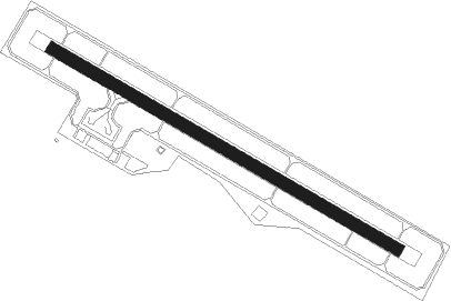
Amakusa
Airport details
| Country | Japan |
| State | Kumamoto Prefecture |
| Region | RJ |
| Airspace | Fukuoka Ctr |
| Municipality | Amakusa |
| Elevation | 335ft (102m) |
| Timezone | GMT +9 |
| Coordinates | 32.48222, 130.15889 |
| Magnetic var | |
| Type | land |
| Available since | X-Plane v10.32 |
| ICAO code | RJDA |
| IATA code | AXJ |
| FAA code | n/a |
Communication
| Amakusa Amakusa Flight Service | 130.775 |
Nearby Points of Interest:
Hara Castle
-Kosuge Slip Dock
-Former Latin Divinity School, Nagasaki
-Former British Consulate, Nagasaki
-Narutaki-juku
-Dejima
-Nagasaki Kunchi
-Takashima Coal Mine
-Nagasaki
-Shitsu Church
-Ōno Village
-Ōno Church
Runway info
| Runway 13 / 31 | ||
| length | 1001m (3284ft) | |
| bearing | 120° / 300° | |
| width | 30m (99ft) | |
| surface | asphalt | |
| blast zone | 61m (200ft) / 61m (200ft) | |
Nearby beacons
| code | identifier | dist | bearing | frequency |
|---|---|---|---|---|
| AKE | AMAKUSA VOR/DME | 0.1 | 134° | 113.45 |
| OLE | NAGASAKI VOR/DME | 28.1 | 330° | 116.60 |
| MNE | MINOSHIMA VOR/DME | 28.9 | 331° | 116.30 |
| JBT | OMURA TACAN | 29 | 333° | 114.05 |
| KUE | KUMAMOTO VOR/DME | 40.4 | 63° | 112.80 |
| SGE | SAGA VOR/DME | 40.5 | 11° | 114.75 |
| KGE | KAJIKI (KAGOSHIMA) VOR/DME | 50.2 | 140° | 115.70 |
| HKC | KAGOSHIMA VORTAC | 51.8 | 152° | 113.30 |
Departure and arrival routes
| Transition altitude | 14000ft |
| Transition level | 14000ft |
| SID end points | distance | outbound heading | |
|---|---|---|---|
| RW13 | |||
| HABOH2 | 38mi | 27° | |
| RW31 | |||
| HABOH2 | 38mi | 27° | |
| STAR starting points | distance | inbound heading | |
|---|---|---|---|
| ALL | |||
| IRUKA, TSUJI | 19.7 | 242° | |
Instrument approach procedures
| runway | airway (heading) | route (dist, bearing) |
|---|---|---|
| RW13-X | TSUJI (156°) | TSUJI ITUWA (3mi, 277°) 2000ft SAKIZ (3mi, 203°) 1800ft |
| RNAV | SAKIZ 1800ft MIZKA (3mi, 120°) 1800ft RJDA (5mi, 120°) 370ft DZ350 (3mi, 120°) FUGEN (19mi, 55°) 4000ft FUGEN (turn) 4000ft | |
| RW13-Z | TSUJI (156°) | TSUJI TOHMI (3mi, 248°) 1800ft |
| RNAV | TOHMI 1800ft MIZKA (3mi, 151°) 1800ft RJDA (5mi, 120°) 370ft (7385mi, 256°) 840ft FUGEN (7395mi, 76°) 4000ft FUGEN (turn) 4000ft | |
| RW31-X | IRUKA (274°) | IRUKA 4000ft DATEK (8mi, 238°) 3100ft |
| RNAV | DATEK 3100ft GOSKI (3mi, 300°) 2600ft DZ150 (4mi, 300°) 1439ft DZ152 (2mi, 300°) 657ft DZ153 (5mi, 300°) IRUKA (18mi, 99°) 4000ft IRUKA (turn) 4000ft | |
| RW31-Z | IRUKA (274°) | IRUKA 4000ft DATEK (8mi, 238°) 2900ft |
| RNAV | DATEK 2900ft GOSKI (3mi, 300°) 2600ft DZ150 (4mi, 300°) 1439ft DZ151 (3mi, 300°) 485ft (7385mi, 256°) 840ft IRUKA (7399mi, 76°) 4000ft IRUKA (turn) 4000ft |
Holding patterns
| STAR name | hold at | type | turn | heading* | altitude | leg | speed limit |
|---|---|---|---|---|---|---|---|
| IRUKA | FUGEN | VHF | right | 65 (245)° | > 4000ft | DME 4.3mi | 170 |
| TSUJI | FUGEN | VHF | right | 65 (245)° | > 4000ft | DME 4.3mi | 170 |
| *) magnetic outbound (inbound) holding course | |||||||
Disclaimer
The information on this website is not for real aviation. Use this data with the X-Plane flight simulator only! Data taken with kind consent from X-Plane 12 source code and data files. Content is subject to change without notice.
