Kamigoto
Airport details
| Country | Japan |
| State | Nagasaki Prefecture |
| Region | RJ |
| Airspace | Fukuoka Ctr |
| Municipality | Shinkami Gotou |
| Elevation | 264ft (80m) |
| Timezone | GMT +9 |
| Coordinates | 33.01361, 129.19250 |
| Magnetic var | |
| Type | land |
| Available since | X-Plane v10.40 |
| ICAO code | RJDK |
| IATA code | n/a |
| FAA code | n/a |
Communication
| Kamigoto Nagasaki Radio (RAG) | 118.000 |
Nearby Points of Interest:
Former Nokubi Church
-Hidden Christian Sites in the Nagasaki Region
-Former Gorin Church
-Mount Yasuman
-Nakaenoshima
-Ōno Church
-Ōno Village
-Shitsu Church
-Saiwai Bridge
-Kurokoshima
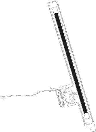
Runway info
| Runway 17 / 35 | ||
| length | 801m (2628ft) | |
| bearing | 166° / 346° | |
| width | 25m (82ft) | |
| surface | asphalt | |
| blast zone | 60m (197ft) / 60m (197ft) | |
Nearby beacons
| code | identifier | dist | bearing | frequency |
|---|---|---|---|---|
| FUE | FUKUE VOR/DME | 27.7 | 227° | 115.80 |
| MNE | MINOSHIMA VOR/DME | 36.9 | 97° | 116.30 |
| OLE | NAGASAKI VOR/DME | 37.1 | 98° | 116.60 |
| JBT | OMURA TACAN | 37.6 | 97° | 114.05 |
| IKE | IKI (IKISHIMA) VOR/DME | 52.9 | 39° | 113.20 |
| AKE | AMAKUSA VOR/DME | 58.4 | 119° | 113.45 |
Disclaimer
The information on this website is not for real aviation. Use this data with the X-Plane flight simulator only! Data taken with kind consent from X-Plane 12 source code and data files. Content is subject to change without notice.