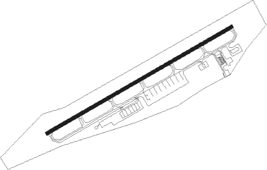
Kumamoto
Airport details
| Country | Japan |
| State | Kumamoto Prefecture |
| Region | RJ |
| Airspace | Fukuoka Ctr |
| Municipality | Kikuyou |
| Elevation | 642ft (196m) |
| Timezone | GMT +9 |
| Coordinates | 32.83995, 130.86948 |
| Magnetic var | |
| Type | land |
| Available since | X-Plane v10.40 |
| ICAO code | RJFT |
| IATA code | KMJ |
| FAA code | n/a |
Communication
| Kumamoto ATIS | 128.800 |
| Kumamoto Ground Control | 121.800 |
| Kumamoto Tower | 122.900 |
| Kumamoto Tower | 126.200 |
| Kumamoto Tower | 118.700 |
| Kumamoto RAD | 122.900 |
| Kumamoto Approach | 122.900 |
| Kumamoto TCA | 123.850 |
| Kumamoto Approach | 119.000 |
| Kumamoto FUKUOKA CON | 118.900 |
| Kumamoto Approach | 126.500 |
| Kumamoto FUKUOKA CON | 132.900 |
| Kumamoto Departure | 122.900 |
Approach frequencies
| ILS-cat-III | RW07 | 109.3 | 18.00mi |
| 3° GS | RW07 | 109.3 | 18.00mi |
Nearby Points of Interest:
Eta Funayama Kofun
-Port of Miike
-Hara Castle
Nearby beacons
| code | identifier | dist | bearing | frequency |
|---|---|---|---|---|
| KUE | KUMAMOTO VOR/DME | 1.4 | 260° | 112.80 |
| SGE | SAGA VOR/DME | 34.4 | 298° | 114.75 |
| AKE | AMAKUSA VOR/DME | 41.8 | 243° | 113.45 |
| JBT | OMURA TACAN | 47.5 | 275° | 114.05 |
| OLE | NAGASAKI VOR/DME | 48.1 | 274° | 116.60 |
| MNE | MINOSHIMA VOR/DME | 48.2 | 275° | 116.30 |
| TQT | TSUIKI TACAN | 51.6 | 11° | 110.40 |
| NHT | NYUTABARU TACAN | 54.3 | 142° | 115 |
| ZZT | NYUTABARU TACAN | 54.3 | 142° | 135.90 |
| DGC | FUKUOKA VORTAC | 55.7 | 330° | 114.50 |
| TFE | MUSASHI (OITA) VOR/DME | 58.2 | 53° | 117.70 |
| MZE | MIYAZAKI VOR/DME | 64.5 | 149° | 112.40 |
Departure and arrival routes
| Transition altitude | 14000ft |
| Transition level | 14000ft |
| SID end points | distance | outbound heading | |
|---|---|---|---|
| RW07 | |||
| RINDO5 | 58mi | 53° | |
| MIFNE1 | 116mi | 69° | |
| HINAG4 | 32mi | 219° | |
| IRUKA2 | 31mi | 228° | |
| RW25 | |||
| RINDO5 | 58mi | 53° | |
| MIFNE1 | 116mi | 69° | |
| HINAG4 | 32mi | 219° | |
| IRUKA2 | 31mi | 228° | |
| STAR starting points | distance | inbound heading | |
|---|---|---|---|
| ALL | |||
| MISMIS, TAKASS | 32.1 | 39° | |
| RW07 | |||
| KAZMA | 16.7 | 245° | |
Instrument approach procedures
| runway | airway (heading) | route (dist, bearing) |
|---|---|---|
| RW25-Y | ASONO (245°) | ASONO 8000ft DOUJI (12mi, 277°) 6500ft |
| RNAV | DOUJI 6500ft FT560 (2mi, 277°) 4500ft FT561 (3mi, 256°) 4100ft FUMOT (6mi, 185°) 3200ft FT562 (2mi, 135°) 2650ft FT563 (4mi, 195°) 1216ft RJFT (2mi, 243°) 692ft MISMI (12mi, 249°) 3400ft MISMI (turn) 3400ft | |
| RW25-Z | ASONO (245°) | ASONO 8000ft DIKAN (9mi, 272°) BOCHU (6mi, 203°) 4300ft |
| RNAV | BOCHU 4300ft FT550 (2mi, 203°) 3730ft FT551 (3mi, 236°) 2711ft FT552 (2mi, 265°) 2159ft FT553 (turn) 1858ft RJFT (4mi, 246°) 692ft MISMI (12mi, 249°) 3400ft MISMI (turn) 3400ft |
Holding patterns
| STAR name | hold at | type | turn | heading* | altitude | leg | speed limit |
|---|---|---|---|---|---|---|---|
| MISMIE | MISMI | VHF | right | 251 (71)° | 3400ft - 14000ft | DME 5.5mi | 230 |
| MISMIS | MISMI | VHF | right | 251 (71)° | 3400ft - 14000ft | DME 5.5mi | 230 |
| TAKASE | TAKAS | VHF | left | 297 (117)° | > 3400ft | DME 5.0mi | 220 |
| TAKASS | TAKAS | VHF | left | 297 (117)° | > 3400ft | DME 5.0mi | 220 |
| *) magnetic outbound (inbound) holding course | |||||||
Disclaimer
The information on this website is not for real aviation. Use this data with the X-Plane flight simulator only! Data taken with kind consent from X-Plane 12 source code and data files. Content is subject to change without notice.