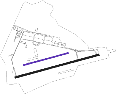
Kanoya
Airport details
| Country | Japan |
| State | Kagoshima Prefecture |
| Region | RJ |
| Airspace | Fukuoka Ctr |
| Municipality | Kanoya |
| Elevation | 212ft (65m) |
| Timezone | GMT +9 |
| Coordinates | 31.37330, 130.82773 |
| Magnetic var | |
| Type | land |
| Available since | X-Plane v10.40 |
| ICAO code | RJFY |
| IATA code | n/a |
| FAA code | n/a |
Communication
| Kanoya Tower | 133.400 |
| Kanoya Tower | 126.200 |
| Kanoya Approach | 126.200 |
| Kanoya Approach | 122.150 |
Approach frequencies
| ILS-cat-I | RW26L | 110.3 | 18.00mi |
| 3° GS | RW26L | 110.3 | 18.00mi |
Nearby Points of Interest:
Shūseikan
-Sengan-en
Nearby beacons
| code | identifier | dist | bearing | frequency |
|---|---|---|---|---|
| JAT | KANOYA TACAN | 0.6 | 166° | 113.80 |
| JA | KANOYA NDB | 1.5 | 130° | 238 |
| HKC | KAGOSHIMA VORTAC | 23.1 | 323° | 113.30 |
| KGE | KAJIKI (KAGOSHIMA) VOR/DME | 26 | 347° | 115.70 |
| MZE | MIYAZAKI VOR/DME | 43.5 | 50° | 112.40 |
| TGE | NAKATANE VOR/DME | 47 | 168° | 115.40 |
| NHT | NYUTABARU TACAN | 53.1 | 42° | 115 |
| ZZT | NYUTABARU TACAN | 53.1 | 42° | 135.90 |
| YKE | YAKUSHIMA VOR/DME | 60.2 | 189° | 117 |
Departure and arrival routes
| Transition altitude | 14000ft |
| Transition level | 14000ft |
| SID end points | distance | outbound heading | |
|---|---|---|---|
| RW08R | |||
| EKORU1 | 34mi | 80° | |
| QUEEN2 | 39mi | 101° | |
| RW26L | |||
| EKORU1 | 34mi | 80° | |
| QUEEN2 | 39mi | 101° | |
| MAKRA2 | 23mi | 257° | |
Holding patterns
| STAR name | hold at | type | turn | heading* | altitude | leg | speed limit |
|---|---|---|---|---|---|---|---|
| AIRAH | AIRAH | VHF | left | 125 (305)° | > 6000ft | DME 3.0mi | 200 |
| *) magnetic outbound (inbound) holding course | |||||||
Disclaimer
The information on this website is not for real aviation. Use this data with the X-Plane flight simulator only! Data taken with kind consent from X-Plane 12 source code and data files. Content is subject to change without notice.

