Okinoerabujima - Okierabu
Airport details
| Country | Japan |
| State | Kagoshima Prefecture |
| Region | RJ |
| Airspace | Fukuoka Ctr |
| Municipality | Wadomari |
| Elevation | 101ft (31m) |
| Timezone | GMT +9 |
| Coordinates | 27.43167, 128.70555 |
| Magnetic var | |
| Type | land |
| Available since | X-Plane v10.40 |
| ICAO code | RJKB |
| IATA code | OKE |
| FAA code | n/a |
Communication
| OKIERABU REMOTE | 118.050 |
Runway info
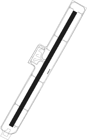
| Runway 04 / 22 | ||
| length | 1351m (4432ft) | |
| bearing | 37° / 217° | |
| width | 45m (147ft) | |
| surface | asphalt | |
| blast zone | 61m (200ft) / 61m (200ft) | |
Nearby beacons
| code | identifier | dist | bearing | frequency |
|---|---|---|---|---|
| ONC | ERABU (OKIERABU I) VORTAC | 0.3 | 280° | 113.10 |
| TKE | TOKUNOSHIMA VOR/DME | 25.4 | 24° | 110.45 |
| AGE | AMAGI VOR/DME | 25.9 | 24° | 111.80 |
| YRE | YORON VOR/DME | 28.4 | 218° | 112.25 |
Departure and arrival routes
| Transition altitude | 14000ft |
| Transition level | 14000ft |
| SID end points | distance | outbound heading | |
|---|---|---|---|
| RW04 | |||
| AZEFU3, MEKA3N, NEORI2 | 65mi | 23° | |
| HORAI1 | 15mi | 37° | |
| YUWAN6, SONNA2 | 60mi | 45° | |
| YUNTA2, ASATO9 | 18mi | 219° | |
| RW22 | |||
| NEORI2, MEKA3N, AZEFU3 | 65mi | 23° | |
| HORAI1 | 15mi | 37° | |
| SONNA2, YUWAN6 | 60mi | 45° | |
| ASATO9, YUNTA2 | 18mi | 219° | |
| STAR starting points | distance | inbound heading | |
|---|---|---|---|
| RW04 | |||
| HACHAS | 46.5 | 203° | |
| PINNES | 31.1 | 225° | |
| RW22 | |||
| HACHAE, HACHAN | 46.5 | 203° | |
| PINNEN, PINNEE | 31.1 | 225° | |
Instrument approach procedures
| runway | airway (heading) | route (dist, bearing) |
|---|---|---|
| RW04 | GOMES (2°) | GOMES 2000ft KB450 (5mi, 301°) 1800ft |
| RW04 | UJIJI (65°) | UJIJI 3000ft KB450 (6mi, 99°) 1800ft |
| RNAV | KB450 1800ft RAGON (4mi, 37°) 1200ft RJKB (4mi, 37°) 148ft KB451 (3mi, 37°) GOMES (12mi, 190°) 2000ft GOMES (turn) 2000ft | |
| RW22 | LILLY (217°) | LILLY KB250 (5mi, 217°) 1200ft |
| RW22 | PAULO (254°) | PAULO KB250 (9mi, 283°) 1200ft |
| RW22 | WANJO (182°) | WANJO KB250 (5mi, 121°) 1200ft |
| RNAV | KB250 1200ft ALDER (4mi, 217°) 1100ft RJKB (3mi, 217°) 129ft KB251 (3mi, 217°) PAULO (16mi, 68°) 2000ft PAULO (turn) 2000ft |
Disclaimer
The information on this website is not for real aviation. Use this data with the X-Plane flight simulator only! Data taken with kind consent from X-Plane 12 source code and data files. Content is subject to change without notice.