Toyama
Airport details
| Country | Japan |
| State | Toyama Prefecture |
| Region | RJ |
| Airspace | Fukuoka Ctr |
| Municipality | Toyama |
| Elevation | 77ft (23m) |
| Timezone | GMT +9 |
| Coordinates | 36.64833, 137.18750 |
| Magnetic var | |
| Type | land |
| Available since | X-Plane v10.40 |
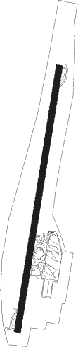
| ICAO code | RJNT |
| IATA code | TOY |
| FAA code | n/a |
Communication
| Toyama Tower | 124.300 |
| Toyama Tokyo Control | 125.600 |
| Toyama Tokyo Control | 128.800 |
| Toyama Tower | 126.200 |
Approach frequencies
| LOC | RW20 | 109.3 | 18.00mi |
Nearby Points of Interest:
Ushijima Lock
-Midagahara
-Ainokura
-Suganuma
-Iwase-ke
-Nanao Castle
-Kurobe Gorge
-Ankoku-ji
-Asanogawa Ōhashi Bridge
-Tatsumi Canal
-Kanazawa Municipal Tamagawa Library
-Historic Villages of Shirakawa-gō and Gokayama
-Shirakawa-gō
-Hida-kokubunji no Ōichō
-Sanmachi
Nearby beacons
| code | identifier | dist | bearing | frequency |
|---|---|---|---|---|
| TOE | TOYAMA VOR/DME | 0.2 | 43° | 110.85 |
| NTE | NOTO VOR/DME | 40 | 341° | 111.45 |
| KMC | KOMATSU VORTAC | 40.7 | 252° | 112 |
| MBE | MATSUMOTO VOR/DME | 46.1 | 124° | 117.60 |
Departure and arrival routes
| Transition altitude | 14000ft |
| Transition level | 14000ft |
| SID end points | distance | outbound heading | |
|---|---|---|---|
| RW02 | |||
| UOZU1, IKUJI5 | 67mi | 38° | |
| URUS4R | 11mi | 342° | |
| RW20 | |||
| IKUJI5, UOZU1 | 67mi | 38° | |
| URUS4R | 11mi | 342° | |
| STAR starting points | distance | inbound heading | |
|---|---|---|---|
| ALL | |||
| MANYO | 21.0 | 84° | |
| NANAO, TOE | 10.6 | 162° | |
| OHANA | 48.6 | 197° | |
| GENGE | 60.4 | 213° | |
Holding patterns
| STAR name | hold at | type | turn | heading* | altitude | leg | speed limit |
|---|---|---|---|---|---|---|---|
| GENGE | NOBEL | VHF | right | 21 (201)° | > 3000ft | DME 6.0mi | ICAO rules |
| OHANA | MEDIC | VHF | right | 21 (201)° | > 3000ft | DME 5.0mi | ICAO rules |
| OHANA | NOBEL | VHF | right | 21 (201)° | > 3000ft | DME 6.0mi | ICAO rules |
| TOE | MEDIC | VHF | right | 21 (201)° | > 3000ft | DME 5.0mi | ICAO rules |
| *) magnetic outbound (inbound) holding course | |||||||
Disclaimer
The information on this website is not for real aviation. Use this data with the X-Plane flight simulator only! Data taken with kind consent from X-Plane 12 source code and data files. Content is subject to change without notice.