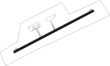
Wajima - Noto
Airport details
| Country | Japan |
| State | Ishikawa Prefecture |
| Region | RJ |
| Airspace | Fukuoka Ctr |
| Municipality | Wajima |
| Elevation | 715ft (218m) |
| Timezone | GMT +9 |
| Coordinates | 37.29555, 136.96074 |
| Magnetic var | |
| Type | land |
| Available since | X-Plane v10.40 |
| ICAO code | RJNW |
| IATA code | NTQ |
| FAA code | n/a |
Communication
Approach frequencies
| ILS-cat-I | RW25 | 108.95 | 18.00mi |
| 3° GS | RW25 | 108.95 | 18.00mi |
Nearby Points of Interest:
Sōji-ji Soin
-Nanao Castle
Nearby beacons
| code | identifier | dist | bearing | frequency |
|---|---|---|---|---|
| NTE | NOTO VOR/DME | 0.3 | 159° | 111.45 |
| TOE | TOYAMA VOR/DME | 40.1 | 160° | 110.85 |
| KMC | KOMATSU VORTAC | 60.2 | 212° | 112 |
Departure and arrival routes
| Transition altitude | 14000ft |
| Transition level | 14000ft |
| SID end points | distance | outbound heading | |
|---|---|---|---|
| RW07 | |||
| HISUI3 | 50mi | 73° | |
| URUSI1 | 30mi | 160° | |
| RW25 | |||
| HISUI3 | 50mi | 73° | |
| URUSI1 | 30mi | 160° | |
| STAR starting points | distance | inbound heading | |
|---|---|---|---|
| ALL | |||
| GORYU | 45.9 | 282° | |
| RW07 | |||
| KILCO | 45.9 | 282° | |
Instrument approach procedures
| runway | airway (heading) | route (dist, bearing) |
|---|---|---|
| RW07-Y | NOPPY (252°) | NOPPY 4200ft BENKO (4mi, 265°) 4200ft |
| RNAV | BENKO 4200ft KONOS (8mi, 265°) 4200ft NW760 (2mi, 265°) 3555ft NW761 (4mi, 162°) 1257ft RJNW (2mi, 67°) 760ft NOPPY (12mi, 72°) 3000ft NOPPY (turn) 3000ft | |
| RW07-Z | KILCO (288°) | KILCO 6000ft TABNO (14mi, 275°) 6000ft |
| RNAV | TABNO 6000ft ENDOH (8mi, 275°) 4200ft NW750 (2mi, 275°) 3639ft NW751 (5mi, 349°) 1284ft RJNW (2mi, 68°) 760ft NOPPY (12mi, 72°) 3000ft NOPPY (turn) 3000ft |
Disclaimer
The information on this website is not for real aviation. Use this data with the X-Plane flight simulator only! Data taken with kind consent from X-Plane 12 source code and data files. Content is subject to change without notice.
