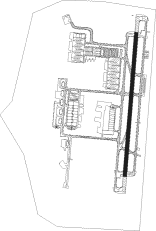
Iwakuni - Mcas-iwakuni
Airport details
| Country | Japan |
| State | Yamaguchi Prefecture |
| Region | RJ |
| Airspace | Fukuoka Ctr |
| Municipality | Iwakuni |
| Elevation | 8ft (2m) |
| Timezone | GMT +9 |
| Coordinates | 34.15240, 132.25072 |
| Magnetic var | |
| Type | land |
| Available since | X-Plane v10.40 |
| ICAO code | RJOI |
| IATA code | IWK |
| FAA code | n/a |
Communication
| MCAS-Iwakuni ATIS Frequency | 128.400 |
| MCAS-Iwakuni CLR DEL Frequency | 135.700 |
| MCAS-Iwakuni Ground Frequency | 121.300 |
| MCAS-Iwakuni Tower Frequency | 123.800 |
| MCAS-Iwakuni Approach Frequency | 128.000 |
| MCAS-Iwakuni Departure Frequency | 128.000 |
Approach frequencies
| ILS-cat-I | RW02 | 110.15 | 18.00mi |
| 3° GS | RW02 | 110.15 | 18.00mi |
Nearby Points of Interest:
Fukuromachi Elementary School Peace Museum
-Sandan-kyō
-Dōgo Onsen Honkan
Nearby beacons
| code | identifier | dist | bearing | frequency |
|---|---|---|---|---|
| NEU | IWAKUNI TACAN | 0.4 | 319° | 109.80 |
| IWT | KUGA TACAN | 6.7 | 235° | 114.30 |
| MYE | MATSUYAMA VOR/DME | 29.2 | 126° | 110.65 |
| FMT | HOFU TACAN | 35.7 | 261° | 113 |
| HGE | HONGO (HIROSHIMA) VOR/DME | 37.4 | 67° | 117.90 |
| IME | IWAMI VOR/DME | 39.1 | 318° | 115.05 |
| TFE | MUSASHI (OITA) VOR/DME | 47.5 | 218° | 117.70 |
| UBE | UBE (YAMAGUCHI) VOR/DME | 49.8 | 257° | 110.80 |
Departure and arrival routes
| Transition altitude | 14000ft |
| Transition level | 14000ft |
| SID end points | distance | outbound heading | |
|---|---|---|---|
| RW02 | |||
| MYESE3 | 49mi | 100° | |
| RW20 | |||
| MYESE3 | 49mi | 100° | |
Instrument approach procedures
| runway | airway (heading) | route (dist, bearing) |
|---|---|---|
| RW02 | MYE (306°) | MYE 3700ft PPOPS (25mi, 277°) 3700ft PPOPS (turn) 3700ft |
| RW02 | TFE (38°) | TFE 3700ft PPOPS (34mi, 50°) 3700ft PPOPS (turn) 3700ft |
| RNAV | PPOPS 3700ft TAZZZ (5mi, 11°) 3200ft STYNE (4mi, 11°) 1960ft ORLFD (3mi, 11°) 1040ft RJOI (4mi, 13°) 65ft (7436mi, 256°) 279ft MYE (7464mi, 76°) 6000ft MYE (turn) 9000ft |
Disclaimer
The information on this website is not for real aviation. Use this data with the X-Plane flight simulator only! Data taken with kind consent from X-Plane 12 source code and data files. Content is subject to change without notice.
