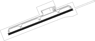
Takamatsu
Airport details
| Country | Japan |
| State | Kagawa Prefecture |
| Region | RJ |
| Airspace | Fukuoka Ctr |
| Municipality | Takamatsu |
| Elevation | 605ft (184m) |
| Timezone | GMT +9 |
| Coordinates | 34.21596, 134.01645 |
| Magnetic var | |
| Type | land |
| Available since | X-Plane v10.40 |
| ICAO code | RJOT |
| IATA code | TAK |
| FAA code | n/a |
Communication
| Takamatsu ATIS | 127.450 |
| Takamatsu Tower | 118.300 |
| Takamatsu Tower | 126.200 |
| Takamatsu Tower | 135.900 |
| Takamatsu TCA | 119.025 |
| Takamatsu Approach | 121.200 |
| Takamatsu Approach | 120.400 |
| Takamatsu Departure | 121.200 |
| Takamatsu Departure | 120.400 |
Approach frequencies
| ILS-cat-I | RW26 | 109.7 | 18.00mi |
| 3° GS | RW26 | 109.7 | 18.00mi |
Nearby Points of Interest:
Manno Lake
-Konpira Grand Theatre
-Shiwaku Kinbansho
-Ikeda no Sajiki
-Kankakei
-Kurashiki Bikan Historical Quarter
-Old Ohara House
-Shūraku-en
-Old Tokushima Castle Omotegoten Garden
-Buraku-ji
-Naruto Strait
-Tomonoura
Nearby beacons
| code | identifier | dist | bearing | frequency |
|---|---|---|---|---|
| KTE | KAGAWA (TAKAMATSU) VOR/DME | 0.3 | 119° | 108.40 |
| TZT | TAKAMATSU TACAN | 7.3 | 330° | 117.50 |
| STD | DME | 21.9 | 41° | 114.40 |
| OKT | OKAYAMA TACAN | 27.3 | 360° | 115.90 |
| TS | TOKUSHIMA NDB | 29.7 | 98° | 332 |
| TSC | TOKUSHIMA VORTAC | 29.8 | 98° | 114.90 |
| KJT | KOMATSUSHIMA TACAN | 32.8 | 109° | 113.55 |
| OYE | KIBI VOR/DME | 33.3 | 341° | 111 |
| AJD | DME | 34.7 | 86° | 115.60 |
| KRE | KOCHI VOR/DME | 43.8 | 207° | 113.70 |
Departure and arrival routes
| Transition altitude | 14000ft |
| Transition level | 14000ft |
| SID end points | distance | outbound heading | |
|---|---|---|---|
| RW08 | |||
| SAYOH2 | 94mi | 42° | |
| OLIVE2 | 150mi | 78° | |
| WASYU3 | 35mi | 292° | |
| TAROH3 | 91mi | 325° | |
| KTE3N | 33mi | 341° | |
| RW26 | |||
| SAYOH2 | 94mi | 42° | |
| OLIVE2 | 150mi | 78° | |
| WASYU3 | 35mi | 292° | |
| TAROH3 | 91mi | 325° | |
| KTE3N | 33mi | 341° | |
| STAR starting points | distance | inbound heading | |
|---|---|---|---|
| ALL | |||
| KTE | 29.6 | 237° | |
| RW26 | |||
| POPAI | 29.6 | 237° | |
Disclaimer
The information on this website is not for real aviation. Use this data with the X-Plane flight simulator only! Data taken with kind consent from X-Plane 12 source code and data files. Content is subject to change without notice.
