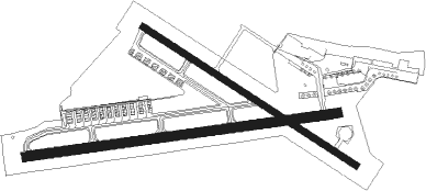
Yao
Airport details
| Country | Japan |
| State | Osaka Prefecture |
| Region | RJ |
| Airspace | Fukuoka Ctr |
| Municipality | Yao |
| Elevation | 39ft (12m) |
| Timezone | GMT +9 |
| Coordinates | 34.59764, 135.60396 |
| Magnetic var | |
| Type | land |
| Available since | X-Plane v10.40 |
| ICAO code | RJOY |
| IATA code | n/a |
| FAA code | n/a |
Communication
| Yao Ground Control | 121.800 |
| Yao Tower | 126.200 |
| Yao Tower | 124.350 |
| Yao KANSAI Approach | 124.700 |
| Yao KANSAI Approach | 120.450 |
Nearby Points of Interest:
Tsudo-shiroyama Kofun
-Oka Misanzai Kofun
-Furuichi kofungun
-Mozu-Furuichi Kofun Group: Mounded Tombs of Ancient Japan
-Karusato Otsuka Kofun
-Harima Shop
-Sumiyoshi Angū
-Shitennō-ji Honbō Garden
-Otaue Shinto Service
-Mozu kofungun
-Dogameyama Kofun
-Nankai Building
-Buddhist Monuments in the Hōryū-ji Area
-Shakyamuni and two attendants of Golden Hall, Hōryū-ji
-Tamamushi Shrine
-Genjō Sanzō-e
-Mengyo Kaikan
-Former Konishi Family Residence
-Kitahama Retro Building
-Osaka Gas Building
-Shibakawa Building
-Tekijuku
Runway info
Nearby beacons
| code | identifier | dist | bearing | frequency |
|---|---|---|---|---|
| YOE | YAO VOR/DME | 0.5 | 275° | 114.60 |
| ITE | ITAMI VOR/DME | 15.9 | 316° | 114.75 |
| KCE | KOBE VOR/DME | 18.6 | 275° | 111.25 |
| KIE | KANSAI VOR/DME | 22.1 | 247° | 111.60 |
| GBD | DME | 48.1 | 216° | 116.90 |
| AJD | DME | 48.3 | 250° | 115.60 |
| TSC | TOKUSHIMA VORTAC | 56.7 | 245° | 114.90 |
| TS | TOKUSHIMA NDB | 56.9 | 245° | 332 |
| NKE | NANKI VOR/DME | 57.5 | 195° | 109.05 |
| YME | MIYAZU VOR/DME | 57.7 | 332° | 112.60 |
| KJT | KOMATSUSHIMA TACAN | 60.2 | 239° | 113.55 |
Departure and arrival routes
| Transition altitude | 14000ft |
| Transition level | 14000ft |
| SID end points | distance | outbound heading | |
|---|---|---|---|
| RW09 | |||
| ASUKA7 | 76mi | 63° | |
| IZUMI2 | 13mi | 229° | |
| RW13 | |||
| ASUKA7 | 76mi | 63° | |
| IZUMI2 | 13mi | 229° | |
| RW27 | |||
| ASUKA7 | 76mi | 63° | |
| IZUMI2 | 13mi | 229° | |
| RW31 | |||
| ASUKA7 | 76mi | 63° | |
| IZUMI2 | 13mi | 229° | |
Disclaimer
The information on this website is not for real aviation. Use this data with the X-Plane flight simulator only! Data taken with kind consent from X-Plane 12 source code and data files. Content is subject to change without notice.

