Shimonoseki - Ozuki
Airport details
| Country | Japan |
| State | Yamaguchi Prefecture |
| Region | RJ |
| Airspace | Fukuoka Ctr |
| Municipality | Shimonoseki |
| Elevation | 13ft (4m) |
| Timezone | GMT +9 |
| Coordinates | 34.04583, 131.05681 |
| Magnetic var | |
| Type | land |
| Available since | X-Plane v10.40 |
| ICAO code | RJOZ |
| IATA code | n/a |
| FAA code | n/a |
Communication
| Ozuki FUKUOKA CTL | 124.100 |
| Ozuki Tower | 126.200 |
| Ozuki Tower | 122.000 |
| Ozuki TSUIKI Approach | 119.225 |
Nearby Points of Interest:
Sumiyoshi Jinja
-Kōzan-ji
-Former Moji Mitsui Club
-Shimonoseki Nabechō Post Office
-Kanmon Straits
-Akiyoshidai
-Kawachi Dam
-Yamaguchi Prefectural Government Museum
-Hagi Castle Town
-Hagi Castle
-Sites of Japan’s Meiji Industrial Revolution: Iron and Steel, Shipbuilding and Coal Mining
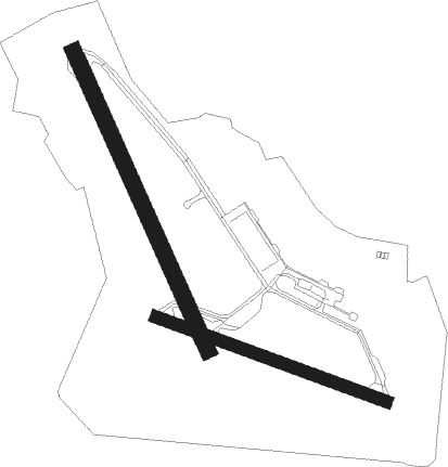
Runway info
Runway 17 / 35  | ||
| length | 1201m (3940ft) | |
| bearing | 157° / 337° | |
| width | 60m (197ft) | |
| surface | asphalt | |
| blast zone | 61m (200ft) / 61m (200ft) | |
| Runway 12 / 30 | ||
| length | 902m (2959ft) | |
| bearing | 111° / 291° | |
| width | 45m (148ft) | |
| surface | asphalt | |
| blast zone | 61m (200ft) / 61m (200ft) | |
Nearby beacons
| code | identifier | dist | bearing | frequency |
|---|---|---|---|---|
| OCT | OZUKI (SHIMONOSEKI) TACAN | 0.3 | 257° | 112.15 |
| SWE | SUOH (KITAKYUSHU) VOR/DME | 11.4 | 188° | 113.85 |
| UBE | UBE (YAMAGUCHI) VOR/DME | 13 | 116° | 110.80 |
| TQT | TSUIKI TACAN | 21.5 | 183° | 110.40 |
| AHT | ASHIYA TACAN | 22.3 | 249° | 108.60 |
| FMT | HOFU TACAN | 24.3 | 91° | 113 |
| DGC | FUKUOKA VORTAC | 39.9 | 241° | 114.50 |
| MIT | MISHIMA TACAN | 43.7 | 6° | 110.60 |
| TFE | MUSASHI (OITA) VOR/DME | 47.3 | 130° | 117.70 |
| IME | IWAMI VOR/DME | 52.1 | 49° | 115.05 |
| SGE | SAGA VOR/DME | 66 | 220° | 114.75 |
Departure and arrival routes
| Transition altitude | 14000ft |
| Transition level | 14000ft |
| SID end points | distance | outbound heading | |
|---|---|---|---|
| RW17 | |||
| OCT3R | 54mi | 88° | |
| RW35 | |||
| OCT3R | 54mi | 88° | |
Disclaimer
The information on this website is not for real aviation. Use this data with the X-Plane flight simulator only! Data taken with kind consent from X-Plane 12 source code and data files. Content is subject to change without notice.