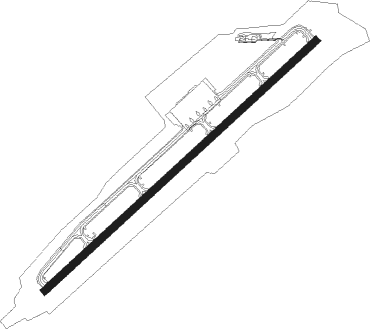
Aomori
Airport details
| Country | Japan |
| State | Aomori Prefecture |
| Region | RJ |
| Airspace | Fukuoka Ctr |
| Municipality | Aomori |
| Elevation | 664ft (202m) |
| Timezone | GMT +9 |
| Coordinates | 40.73333, 140.68861 |
| Magnetic var | |
| Type | land |
| Available since | X-Plane v10.32 |
| ICAO code | RJSA |
| IATA code | AOJ |
| FAA code | n/a |
Communication
| Aomori Tower | 126.200 |
| Aomori Tower | 118.300 |
| Aomori Sapporo Control | 127.575 |
| Aomori Sapporo Control | 120.575 |
Approach frequencies
| ILS-cat-III | RW24 | 111.9 | 18.00mi |
| 3° GS | RW24 | 111.9 | 18.00mi |
Nearby Points of Interest:
Irie-Takasago Shell Midden
-Nakamachi Komise Street
-Horikoshi Castle
-Nakachō
-Ōmori Katsuyama Site
-Oirase Steam
-Jōmon Prehistoric Sites in Northern Japan
-Ōdai Yamamoto I Site
-Shichinohe Castle
Nearby beacons
| code | identifier | dist | bearing | frequency |
|---|---|---|---|---|
| MRE | AOMORI VOR/DME | 0.8 | 72° | 114.10 |
| MIS | MISAWA VORTAC | 31.5 | 92° | 115.40 |
| ODE | ODATE VOR/DME | 35.4 | 211° | 114.75 |
| OMT | OMINATO TACAN | 36.1 | 42° | 114.85 |
| HVT | HACHINOHE TACAN | 37.1 | 103° | 108.60 |
| JC | HACHINOHE NDB | 37.6 | 103° | 381 |
Departure and arrival routes
| Transition altitude | 14000ft |
| Transition level | 14000ft |
| SID end points | distance | outbound heading | |
|---|---|---|---|
| RW06 | |||
| TIKYU3 | 61mi | 27° | |
| OHMAR1 | 37mi | 27° | |
| SHIRA1, IWAKI6 | 71mi | 204° | |
| RW24 | |||
| OHMAR1 | 37mi | 27° | |
| TIKYU3 | 61mi | 27° | |
| IWAKI6, SHIRA1 | 71mi | 204° | |
| STAR starting points | distance | inbound heading | |
|---|---|---|---|
| ALL | |||
| MELOSS | 14.6 | 5° | |
| MELOSN | 16.3 | 190° | |
Instrument approach procedures
| runway | airway (heading) | route (dist, bearing) |
|---|---|---|
| RW06-Y | BYOBU (190°) | BYOBU 6000ft ABURA (6mi, 213°) 5100ft |
| RNAV | ABURA 5100ft MIOKA (9mi, 213°) 3500ft SA678 (1mi, 213°) 3085ft SA674 (4mi, 122°) 1312ft RJSA (3mi, 59°) 697ft SA679 (5mi, 59°) BYOBU (13mi, 351°) 6000ft BYOBU (turn) 6000ft | |
| RW06-Z | YACHI (5°) | YACHI 6000ft SA671 (4mi, 347°) 4000ft |
| RNAV | SA671 4000ft GENOA (5mi, 347°) 2700ft SA673 (2mi, 347°) 1983ft SA674 (2mi, 27°) 1312ft RJSA (3mi, 59°) 697ft RJSA (turn) 1200ft SA675 (5mi, 279°) SA676 (9mi, 239°) SA677 (9mi, 134°) YACHI (7mi, 111°) 6000ft YACHI (turn) 6000ft | |
| RW24-Y | BYOBU (190°) | BYOBU 6000ft ASAMU (4mi, 153°) 5100ft |
| RNAV | ASAMU 5100ft SA456 (6mi, 153°) 2400ft SERYU (3mi, 200°) 2400ft RJSA (6mi, 239°) 718ft SA455 (6mi, 239°) BYOBU (21mi, 25°) 6000ft BYOBU (turn) 6000ft | |
| RW24-Z | YACHI (5°) | YACHI 6000ft SA451 (8mi, 31°) 4300ft |
| RNAV | SA451 4300ft NAMBU (5mi, 31°) 3700ft SA453 (2mi, 31°) 3091ft SA454 (4mi, 301°) 1320ft RJSA (3mi, 239°) 718ft SA455 (6mi, 239°) YACHI (11mi, 154°) 6000ft YACHI (turn) 6000ft |
Holding patterns
| STAR name | hold at | type | turn | heading* | altitude | leg | speed limit |
|---|---|---|---|---|---|---|---|
| MELOSN | BYOBU | VHF | right | 14 (194)° | > 6000ft | DME 5.1mi | 230 |
| MELOSS | YACHI | VHF | left | 195 (15)° | 6000ft - 60000ft | DME 5.0mi | 230 |
| *) magnetic outbound (inbound) holding course | |||||||
Disclaimer
The information on this website is not for real aviation. Use this data with the X-Plane flight simulator only! Data taken with kind consent from X-Plane 12 source code and data files. Content is subject to change without notice.
