Ishinomaki - Matsushima Ab
Airport details
| Country | Japan |
| State | Miyagi Prefecture |
| Region | RJ |
| Airspace | Fukuoka Ctr |
| Municipality | Higashimatsushima |
| Elevation | 6ft (2m) |
| Timezone | GMT +9 |
| Coordinates | 38.40306, 141.21194 |
| Magnetic var | |
| Type | land |
| Available since | X-Plane v10.40 |
| ICAO code | RJST |
| IATA code | n/a |
| FAA code | n/a |
Communication
| Matsushima AB Tower | 126.200 |
| Matsushima AB Radar | 134.100 |
| Matsushima AB TCA | 123.850 |
| Matsushima AB Approach | 120.100 |
| Matsushima AB Departure | 120.100 |
Nearby Points of Interest:
Matsushima
-Entsū-in
-Shiogama Jinja
-Mutsu Kokubun-niji
-Shizugawa Bay
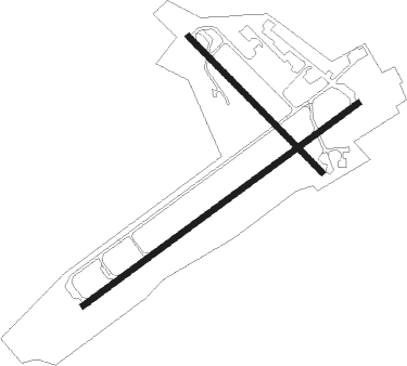
Runway info
Runway 07 / 25  | ||
| length | 2698m (8852ft) | |
| bearing | 64° / 244° | |
| width | 46m (150ft) | |
| surface | concrete | |
| blast zone | 255m (837ft) / 255m (837ft) | |
| Runway 15 / 33 | ||
| length | 1500m (4921ft) | |
| bearing | 133° / 313° | |
| width | 46m (150ft) | |
| surface | concrete | |
| blast zone | 118m (387ft) / 61m (200ft) | |
Nearby beacons
| code | identifier | dist | bearing | frequency |
|---|---|---|---|---|
| MXT | MATSUSHIMA TACAN | 0.6 | 87° | 114.30 |
| SDE | SENDAI VOR/DME | 20.9 | 228° | 116.30 |
| YTE | YAMAGATA VOR/DME | 40.2 | 269° | 113 |
Departure and arrival routes
| Transition altitude | 14000ft |
| Transition level | 14000ft |
| SID end points | distance | outbound heading | |
|---|---|---|---|
| RW07 | |||
| NORTH3, RIASU2 | 94mi | 27° | |
| SOUTH3 | 138mi | 200° | |
| WEST3 | 21mi | 228° | |
| RW25 | |||
| NORTH3, RIASU2 | 94mi | 27° | |
| SOUTH3 | 138mi | 200° | |
| WEST3 | 21mi | 228° | |
Disclaimer
The information on this website is not for real aviation. Use this data with the X-Plane flight simulator only! Data taken with kind consent from X-Plane 12 source code and data files. Content is subject to change without notice.