Camp Zama - Kastner Aaf
Airport details
| Country | Japan |
| State | Tōkyō Prefecture |
| Region | RJ |
| Airspace | Fukuoka Ctr |
| Municipality | Sagamihara |
| Elevation | 359ft (109m) |
| Timezone | GMT +9 |
| Coordinates | 35.51367, 139.39366 |
| Magnetic var | |
| Type | land |
| Available since | X-Plane v10.40 |
| ICAO code | RJTR |
| IATA code | n/a |
| FAA code | n/a |
Communication
| Kastner AAF ASOS | 126.300 |
| Kastner AAF Tower | 122.500 |
| Kastner AAF Yokota Approach | 118.300 |
Nearby Points of Interest:
Yokohama Christ Church
-Shimofuda Site
-Ohkurayama memorial hall
-Takiyama Castle
-Solar Tower Telescope
-Kanagawa Prefectural offices
-Seikadō Bunko Art Museum
-Garden of Engaku-ji
-Kewaizaka
-Daibutsu Pass
-Kobukurozaka
-Tamagawa Aqueduct
-Setagaya Daikanyashiki
-Asaina Pass
-En'yū-ji
-Makino Memorial Garden
-Ginkgo tree of Zenpuku-ji
-Unyo Maru
-Ogasawara-Hakushaku-Tei
-Municipal Research Building
-Tokyo Metropolitan Hibiya Public Hall
-DN Tower 21
-Hayakawa no Biranju
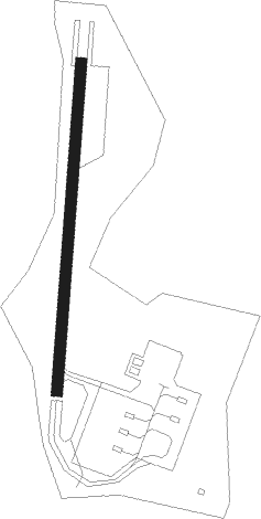
Runway info
| Runway 02 / 20 | ||
| length | 458m (1503ft) | |
| bearing | 11° / 191° | |
| width | 16m (52ft) | |
| surface | asphalt | |
| blast zone | 16m (52ft) / 60m (197ft) | |
Nearby beacons
| code | identifier | dist | bearing | frequency |
|---|---|---|---|---|
| NJA | ATSUGI TACAN | 5 | 139° | 115.10 |
| TNT | TACHIKAWA TACAN | 12.1 | 2° | 115.80 |
| TN | SHIN-TACHIKAWA NDB | 12.2 | 2° | 366 |
| YOK | YOKOTA (TOKYO) TACAN | 14.2 | 350° | 113.80 |
| HME | HANEDA (TOKYO) VOR/DME | 18.1 | 82° | 112.20 |
| HYD | DME | 18.1 | 143° | 116.20 |
| YLT | IRUMA TACAN | 19.6 | 4° | 110.60 |
| KZT | KISARAZU TACAN | 25.9 | 103° | 110.05 |
| SHT | SHIMOFUSA (MATSUDO) TACAN | 34.6 | 65° | 108.20 |
| SYE | SEKIYADO VOR/DME | 36.9 | 42° | 117 |
| SND | (TOKYO) DME | 38.2 | 54° | 114 |
| TET | TATEYAMA TACAN | 39.2 | 141° | 108.80 |
| PQD | DME | 42 | 139° | 112.50 |
| OSE | MIHARA (OSHIMA) VOR/DME | 43.6 | 182° | 109.85 |
| XAC | OSHIMA VORTAC | 48.1 | 179° | 113.10 |
| NRE | NARITA (TOKYO) VOR/DME | 49.9 | 75° | 117.90 |
| TLD | DME | 49.9 | 58° | 116 |
| OJT | ONJUKU TACAN | 51.8 | 109° | 115.70 |
| JD | NIKKO (UTSUNOMIYA) NDB | 62.7 | 26° | 389 |
Disclaimer
The information on this website is not for real aviation. Use this data with the X-Plane flight simulator only! Data taken with kind consent from X-Plane 12 source code and data files. Content is subject to change without notice.