Gwangju
Airport details
| Country | South Korea |
| State | Gwangju Gwang'yeogsi |
| Region | RK |
| Airspace | Incheon Ctr |
| Municipality | Gwangju |
| Elevation | 46ft (14m) |
| Timezone | GMT +9 |
| Coordinates | 35.12639, 126.80889 |
| Magnetic var | |
| Type | land |
| Available since | X-Plane v10.40 |
| ICAO code | RKJJ |
| IATA code | KWJ |
| FAA code | n/a |
Communication
| Gwangju ATIS | 128.875 |
| Gwangju Ground Control | 121.800 |
| Gwangju Tower | 118.050 |
| Gwangju Approach | 130.000 |
| Gwangju ARR | 132.250 |
| Gwangju ARR | 132.700 |
| Gwangju Departure | 124.000 |
Approach frequencies
| LOC | RW22L | 108.5 | 18.00mi |
| ILS-cat-I | RW04R | 111.1 | 18.00mi |
| 3° GS | RW04R | 111.1 | 18.00mi |
Nearby Points of Interest:
Seated Stone Yeorae Statue in Yuchon-dong, Gwangju
-Gochang, Hwasun and Ganghwa Dolmen Sites
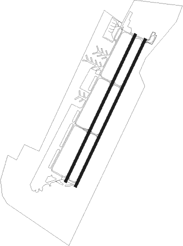
Runway info
Runway 04L / 22R  | ||
| length | 2838m (9311ft) | |
| bearing | 35° / 215° | |
| width | 45m (148ft) | |
| surface | concrete | |
| blast zone | 255m (837ft) / 255m (837ft) | |
| Runway 04R / 22L | ||
| length | 2838m (9311ft) | |
| bearing | 35° / 215° | |
| width | 45m (148ft) | |
| surface | concrete | |
| blast zone | 255m (837ft) / 255m (837ft) | |
Nearby beacons
| code | identifier | dist | bearing | frequency |
|---|---|---|---|---|
| KWA | GWANGJU VOR/DME | 0.1 | 94° | 114.40 |
| KWJ | GWANGJU TACAN | 0.5 | 234° | 114.10 |
| MUN | MUAN VOR/DME | 22.6 | 251° | 111 |
| YS | YEOSU NDB | 42.9 | 109° | 396 |
| YSU | YEOSU VOR/DME | 43.3 | 109° | 115.70 |
| KUZ | KUNSAN VORTAC | 48 | 346° | 112.80 |
Disclaimer
The information on this website is not for real aviation. Use this data with the X-Plane flight simulator only! Data taken with kind consent from X-Plane 12 source code and data files. Content is subject to change without notice.