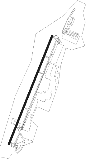
Wonju
Airport details
| Country | South Korea |
| State | Gang'weondo |
| Region | RK |
| Airspace | Incheon Ctr |
| Municipality | Wonju-si |
| Elevation | 329ft (100m) |
| Timezone | GMT +9 |
| Coordinates | 37.43806, 127.96028 |
| Magnetic var | |
| Type | land |
| Available since | X-Plane v10.40 |
| ICAO code | RKNW |
| IATA code | WJU |
| FAA code | n/a |
Communication
| Wonju Wonju Airport ATIS | 128.600 |
| Wonju Wonju Tower | 118.325 |
| Wonju Wonju Tower | 126.200 |
| Wonju Wonju Departure / Approach | 130.200 |
Approach frequencies
| ILS-cat-I | RW03 | 110.1 | 18.00mi |
| ILS-cat-I | RW21 | 111.5 | 18.00mi |
| 3.3° GS | RW03 | 110.1 | 18.00mi |
| 3.3° GS | RW21 | 111.5 | 18.00mi |
Nearby Points of Interest:
Yeoju Godalsaji Seungtap
-Beobcheonsa temple site
-Yeongnyeongneung
-Seven-storied stone pagoda in Tappyeong-ri
-Royal Tombs of the Joseon Dynasty
-Jukrimdong Cathedral
-Danyang Dodamsambong
Nearby beacons
| code | identifier | dist | bearing | frequency |
|---|---|---|---|---|
| WNJ | WONJU TACAN | 0.3 | 164° | 111.60 |
| HGS | WONJU VOR/DME | 2.3 | 21° | 110.20 |
| JWN | CHOONGWON TACAN | 24.5 | 190° | 111.30 |
| CJ | CHUCHON NDB | 29.1 | 332° | 360 |
| KSM | SEOUL VOR/DME | 40.4 | 271° | 109.80 |
| SOL | SEOUL TACAN | 40.4 | 271° | 111.20 |
| KAE | GANGWON VORTAC | 40.9 | 72° | 115.60 |
| SWN | SUWON TACAN | 47.3 | 258° | 108.50 |
| CHO | CHEONGJU VOR/DME | 48.6 | 213° | 109 |
| SOT | SONGTAN VORTAC | 48.9 | 250° | 116.90 |
| CHJ | CHEONGJU TACAN | 49 | 213° | 110.50 |
| YJU | YANGJU VOR/DME | 49.7 | 288° | 114.90 |
| YAG | YANGYANG VOR/DME | 50.1 | 48° | 110.60 |
| LC | KANGNUNG NDB | 50.6 | 73° | 257 |
| KAN | KANGNUNG TACAN | 50.9 | 72° | 111.90 |
| CUN | YECHEON VOR/DME | 51.4 | 156° | 114.80 |
| SK | SOKCHO NDB | 51.7 | 42° | 378 |
| YCN | YECHEON TACAN | 52 | 153° | 108.90 |
| SCH | SOKCHO VOR/DME | 52.3 | 42° | 111 |
| YC | YECHON NDB | 52.4 | 153° | 367 |
| PTK | PYONGTAEK VOR/DME | 53.1 | 244° | 108.20 |
Departure and arrival routes
| Transition altitude | 14000ft |
| Transition level | 14000ft |
| SID end points | distance | outbound heading | |
|---|---|---|---|
| RW03 | |||
| CHISE1 | 12mi | 26° | |
| IKILA1 | 15mi | 288° | |
| RW21 | |||
| HGS7, SANUV2 | 15mi | 288° | |
Instrument approach procedures
| runway | airway (heading) | route (dist, bearing) |
|---|---|---|
| RW03 | ENDEX (54°) | ENDEX 4400ft IKOSU (5mi, 111°) 4400ft DOXEL (5mi, 32°) 3000ft |
| RW03 | IKOSU (32°) | IKOSU 4400ft DOXEL (5mi, 32°) 3000ft |
| RW03 | OLGOD (6°) | OLGOD 5000ft IKOSU (5mi, 292°) 4400ft DOXEL (5mi, 32°) 3000ft |
| RNAV | DOXEL 3000ft KORHA (1mi, 32°) 2600ft OLSAX (3mi, 32°) 1500ft DUBAL (2mi, 32°) 867ft GAREP (14mi, 32°) 6000ft GAREP (turn) | |
| RW21 | ANOTI (212°) | ANOTI 4400ft CASTO (4mi, 212°) 3200ft |
| RW21 | JOOKA (244°) | JOOKA 5600ft ANOTI (8mi, 292°) 4400ft CASTO (4mi, 212°) 3200ft |
| RW21 | VEMTI (186°) | VEMTI 4400ft ANOTI (5mi, 112°) 4400ft CASTO (4mi, 212°) 3200ft |
| RNAV | CASTO 3200ft OLTOV (2mi, 212°) 2600ft POLLU (3mi, 212°) 1500ft ANKEG (2mi, 212°) 874ft GADDY (7mi, 212°) SUSAP (7mi, 239°) KAGER (5mi, 224°) 6000ft KAGER (turn) |
Holding patterns
| STAR name | hold at | type | turn | heading* | altitude | leg | speed limit |
|---|---|---|---|---|---|---|---|
| GANAM1 | OGEBU | VHF | right | 34 (214)° | < 60000ft | DME 5.0mi | 230 |
| *) magnetic outbound (inbound) holding course | |||||||
Disclaimer
The information on this website is not for real aviation. Use this data with the X-Plane flight simulator only! Data taken with kind consent from X-Plane 12 source code and data files. Content is subject to change without notice.