Jeju City - Jeju Intl
Airport details
| Country | South Korea |
| State | Jejudo |
| Region | RK |
| Airspace | Incheon Ctr |
| Municipality | Jeju |
| Elevation | 118ft (36m) |
| Timezone | GMT +9 |
| Coordinates | 33.51222, 126.49277 |
| Magnetic var | |
| Type | land |
| Available since | X-Plane v10.40 |
| ICAO code | RKPC |
| IATA code | CJU |
| FAA code | n/a |
Communication
| Jeju Intl ATIS | 126.800 |
| Jeju Intl Jeju Ground | 121.650 |
| Jeju Intl Jeju Tower | 118.125 |
| Jeju Intl Jeju Tower | 118.200 |
| Jeju Intl Jeju Approach | 124.050 |
| Jeju Intl Jeju Approach | 119.000 |
| Jeju Intl Jeju Approach | 121.200 |
| Jeju Intl Jeju Departure | 119.225 |
Approach frequencies
| ILS-cat-II | RW07 | 109.9 | 18.00mi |
| ILS-cat-I | RW25 | 111.3 | 18.00mi |
| 3° GS | RW25 | 111.3 | 18.00mi |
| 3° GS | RW07 | 109.9 | 18.00mi |
Nearby Points of Interest:
Jeju Volcanic Island and Lava Tubes
-Yongcheon Cave
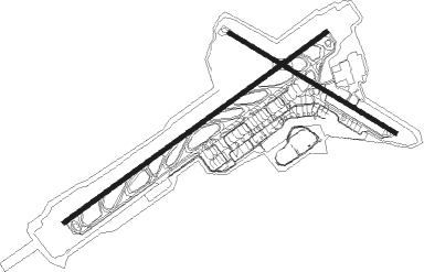
Runway info
Runway 07 / 25  | ||
| length | 3183m (10443ft) | |
| bearing | 63° / 243° | |
| width | 45m (148ft) | |
| surface | asphalt | |
| blast zone | 123m (404ft) / 121m (397ft) | |
| Runway 13 / 31 | ||
| length | 1902m (6240ft) | |
| bearing | 121° / 301° | |
| width | 45m (148ft) | |
| surface | asphalt | |
| displ threshold | 0m (0ft) / 411m (1348ft) | |
Nearby beacons
| code | identifier | dist | bearing | frequency |
|---|---|---|---|---|
| YDM | YONG DAM (JEJU) VOR/DME | 0.2 | 262° | 109 |
| CJU | JEJU VORTAC | 10.1 | 134° | 116.10 |
| JDG | JEDONG (JEJU) VOR/DME | 13.2 | 118° | 117.90 |
Departure and arrival routes
| Transition altitude | 14000ft |
| SID end points | distance | outbound heading | |
|---|---|---|---|
| RW07 | |||
| IPDA4K | 46mi | 17° | |
| KAMI2E | 47mi | 21° | |
| MAKE2E, MAKE4K | 48mi | 64° | |
| TAMN2E, TAMN2K | 42mi | 93° | |
| CJU4K | 10mi | 134° | |
| PANS2E | 34mi | 209° | |
| LIMD1E | 33mi | 274° | |
| RW25 | |||
| KAMI1W | 47mi | 21° | |
| MAKE2W | 48mi | 64° | |
| TAMN2W | 42mi | 93° | |
| CJU2L | 10mi | 134° | |
| PANS2W | 34mi | 209° | |
| LIMD1W | 33mi | 274° | |
| RW31 | |||
| KAMI2N | 47mi | 21° | |
| MAKE2N | 48mi | 64° | |
| STAR starting points | distance | inbound heading | |
|---|---|---|---|
| RW07 | |||
| SOSD2P | 30.6 | 4° | |
| LIMD1P | 33.2 | 94° | |
| DOTO2P | 44.9 | 189° | |
| MAKE2P | 48.3 | 244° | |
| TAMN2P | 42.0 | 273° | |
| TOSA2P | 33.6 | 331° | |
| RW25 | |||
| SOSD2T | 30.6 | 4° | |
| LIMD1T | 33.2 | 94° | |
| DOTO2T | 44.9 | 189° | |
| MAKE2T | 48.3 | 244° | |
| TAMN2T | 42.0 | 273° | |
| TOSA2T | 33.6 | 331° | |
Instrument approach procedures
| runway | airway (heading) | route (dist, bearing) |
|---|---|---|
| RW07 | YUMIN (79°) | YUMIN 4000ft KONDE (5mi, 114°) 2900ft |
| RNAV | KONDE 2900ft TEWOO (4mi, 63°) 1800ft PC401 (2mi, 63°) 1000ft RKPC (4mi, 63°) 137ft PC404 (4mi, 63°) 8000ft PAION (19mi, 94°) 8000ft PAION (turn) 9000ft | |
| RW25 | HANUL (243°) | HANUL 4000ft ESIBO (5mi, 243°) 2900ft |
| RNAV | ESIBO 2900ft SARHA (5mi, 243°) 1800ft RKPC (6mi, 243°) 126ft PC403 (15mi, 243°) 6000ft GIEUN (6mi, 258°) 6000ft GIEUN (turn) 11000ft |
Holding patterns
| STAR name | hold at | type | turn | heading* | altitude | leg | speed limit |
|---|---|---|---|---|---|---|---|
| DOTO2P | CHANY | VHF | left | 226 (46)° | 9000ft - 13000ft | 1.5min timed | 250 |
| DOTO2P | YUMIN | VHF | left | 305 (125)° | 4000ft - 7000ft | 1.0min timed | 230 |
| DOTO2T | HANUL | VHF | right | 65 (245)° | 4000ft - 7000ft | 1.0min timed | 230 |
| DOTO2T | WOODO | VHF | right | 170 (350)° | 9000ft - 16000ft | 1.0min timed | 230 |
| LIMD1P | CHANY | VHF | left | 226 (46)° | 9000ft - 13000ft | 1.5min timed | 250 |
| LIMD1P | CJU | NDB | right | 206 (26)° | 27000ft - 34000ft | 1.5min timed | 280 |
| LIMD1P | YUMIN | VHF | left | 305 (125)° | 4000ft - 7000ft | 1.0min timed | 230 |
| LIMD1T | HANUL | VHF | right | 65 (245)° | 4000ft - 7000ft | 1.0min timed | 230 |
| LIMD1T | WOODO | VHF | right | 170 (350)° | 9000ft - 16000ft | 1.0min timed | 230 |
| MAKE2P | CHANY | VHF | left | 226 (46)° | 9000ft - 13000ft | 1.5min timed | 250 |
| MAKE2P | YUMIN | VHF | left | 305 (125)° | 4000ft - 7000ft | 1.0min timed | 230 |
| MAKE2T | HANUL | VHF | right | 65 (245)° | 4000ft - 7000ft | 1.0min timed | 230 |
| MAKE2T | WOODO | VHF | right | 170 (350)° | 9000ft - 16000ft | 1.0min timed | 230 |
| SOSD2P | CHANY | VHF | left | 226 (46)° | 9000ft - 13000ft | 1.5min timed | 250 |
| SOSD2P | CJU | NDB | right | 206 (26)° | 27000ft - 34000ft | 1.5min timed | 280 |
| SOSD2P | YUMIN | VHF | left | 305 (125)° | 4000ft - 7000ft | 1.0min timed | 230 |
| SOSD2T | HANUL | VHF | right | 65 (245)° | 4000ft - 7000ft | 1.0min timed | 230 |
| SOSD2T | WOODO | VHF | right | 170 (350)° | 9000ft - 16000ft | 1.0min timed | 230 |
| TAMN2P | CHANY | VHF | left | 226 (46)° | 9000ft - 13000ft | 1.5min timed | 250 |
| TAMN2P | CJU | NDB | right | 206 (26)° | 27000ft - 34000ft | 1.5min timed | 280 |
| TAMN2P | YUMIN | VHF | left | 305 (125)° | 4000ft - 7000ft | 1.0min timed | 230 |
| TAMN2T | HANUL | VHF | right | 65 (245)° | 4000ft - 7000ft | 1.0min timed | 230 |
| TAMN2T | WOODO | VHF | right | 170 (350)° | 9000ft - 16000ft | 1.0min timed | 230 |
| TOSA2P | CHANY | VHF | left | 226 (46)° | 9000ft - 13000ft | 1.5min timed | 250 |
| TOSA2P | CJU | NDB | right | 206 (26)° | 27000ft - 34000ft | 1.5min timed | 280 |
| TOSA2P | YUMIN | VHF | left | 305 (125)° | 4000ft - 7000ft | 1.0min timed | 230 |
| TOSA2T | HANUL | VHF | right | 65 (245)° | 4000ft - 7000ft | 1.0min timed | 230 |
| TOSA2T | WOODO | VHF | right | 170 (350)° | 9000ft - 16000ft | 1.0min timed | 230 |
| *) magnetic outbound (inbound) holding course | |||||||
Disclaimer
The information on this website is not for real aviation. Use this data with the X-Plane flight simulator only! Data taken with kind consent from X-Plane 12 source code and data files. Content is subject to change without notice.