Jeju/jeongseok - Jeongseok
Airport details
| Country | South Korea |
| State | Jejudo |
| Region | RK |
| Airspace | Incheon Ctr |
| Municipality | Seogwipo-si |
| Elevation | 1173ft (358m) |
| Timezone | GMT +9 |
| Coordinates | 33.39833, 126.71306 |
| Magnetic var | |
| Type | land |
| Available since | X-Plane v10.40 |
| ICAO code | RKPD |
| IATA code | JDG |
| FAA code | n/a |
Communication
| Jeongseok ATIS | 128.250 |
| Jeongseok Ground Control | 121.950 |
| Jeongseok Tower | 124.350 |
| Jeongseok JEJU Approach | 119.000 |
| Jeongseok JEJU Approach | 121.200 |
| Jeongseok JEJU Approach | 124.050 |
| Jeongseok JEJU Departure | 119.225 |
Approach frequencies
| ILS-cat-I | RW01 | 108.3 | 18.00mi |
| 3° GS | RW01 | 108.3 | 18.00mi |
Nearby Points of Interest:
Jeju Volcanic Island and Lava Tubes
-Yongcheon Cave
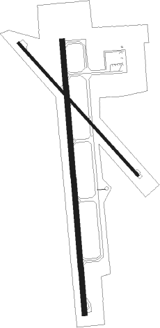
Runway info
Runway 01 / 19  | ||
| length | 2306m (7566ft) | |
| bearing | 360° / 180° | |
| width | 45m (148ft) | |
| surface | asphalt | |
| blast zone | 0m (0ft) / 200m (656ft) | |
| Runway 15 / 33 | ||
| length | 1501m (4925ft) | |
| bearing | 137° / 317° | |
| width | 25m (82ft) | |
| surface | asphalt | |
| displ threshold | 300m (984ft) / 300m (984ft) | |
Nearby beacons
| code | identifier | dist | bearing | frequency |
|---|---|---|---|---|
| JDG | JEDONG (JEJU) VOR/DME | 0.3 | 167° | 117.90 |
| CJU | JEJU VORTAC | 4.5 | 261° | 116.10 |
| YDM | YONG DAM (JEJU) VOR/DME | 13.1 | 297° | 109 |
Departure and arrival routes
| Transition altitude | 14000ft |
| SID end points | distance | outbound heading | |
|---|---|---|---|
| RW01 | |||
| EGOM1N | 14mi | 221° | |
| RW19 | |||
| SUPU1A | 11mi | 82° | |
| EGOM1S | 14mi | 221° | |
Instrument approach procedures
| runway | airway (heading) | route (dist, bearing) |
|---|---|---|
| RW01 | MUPAS (42°) | MUPAS 6000ft PD501 (10mi, 76°) 3800ft |
| RW01 | TENUL (309°) | TENUL 6000ft PD501 (10mi, 269°) 3800ft |
| RNAV | PD501 3800ft PD502 (4mi, 360°) 2700ft RKPD (6mi, 1°) 1152ft PD515 (2mi, 356°) PD516 (7mi, 108°) TENUL (10mi, 153°) 6000ft TENUL (turn) 7000ft |
Holding patterns
| STAR name | hold at | type | turn | heading* | altitude | leg | speed limit |
|---|---|---|---|---|---|---|---|
| CJU1T | TENUL | VHF | right | 140 (320)° | 6000ft - 7000ft | 1.0min timed | 210 |
| GEB1A | TENUL | VHF | right | 140 (320)° | 6000ft - 7000ft | 1.0min timed | 210 |
| TDL1A | TENUL | VHF | right | 140 (320)° | 6000ft - 7000ft | 1.0min timed | 210 |
| TODA1T | TENUL | VHF | right | 140 (320)° | 6000ft - 7000ft | 1.0min timed | 210 |
| *) magnetic outbound (inbound) holding course | |||||||
Disclaimer
The information on this website is not for real aviation. Use this data with the X-Plane flight simulator only! Data taken with kind consent from X-Plane 12 source code and data files. Content is subject to change without notice.