Sacheon - Sacheon Ab
Airport details
| Country | South Korea |
| State | Gyeongsangnamdo |
| Region | RK |
| Airspace | Incheon Ctr |
| Municipality | Sacheon-si |
| Elevation | 22ft (7m) |
| Timezone | GMT +9 |
| Coordinates | 35.08861, 128.07056 |
| Magnetic var | |
| Type | land |
| Available since | X-Plane v10.40 |
| ICAO code | RKPS |
| IATA code | HIN |
| FAA code | n/a |
Communication
| Sacheon AB ATIS | 126.225 |
| Sacheon AB Tower/Ground Control | 118.675 |
| Sacheon AB Departure/Approach | 135.400 |
Approach frequencies
| LOC | RW06L | 109.1 | 18.00mi |
| ILS-cat-I | RW24R | 108.1 | 18.00mi |
| 3.2° GS | RW24R | 108.1 | 18.00mi |
Nearby Points of Interest:
Namhae Japanese Castle
-Haman Marisan Tumuli
-Three-story Stone Pagoda at Baekjangam of Silsangsa Temple in Namwon, Korea
-Hapcheon Okjeon Tumuli
-Suncheon Bay
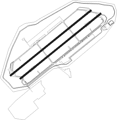
Runway info
Runway 06L / 24R  | ||
| length | 2743m (8999ft) | |
| bearing | 61° / 241° | |
| width | 46m (151ft) | |
| surface | asphalt | |
| blast zone | 177m (581ft) / 230m (755ft) | |
| Runway 06R / 24L | ||
| length | 2741m (8993ft) | |
| bearing | 61° / 241° | |
| width | 46m (151ft) | |
| surface | concrete | |
| blast zone | 255m (837ft) / 255m (837ft) | |
Nearby beacons
| code | identifier | dist | bearing | frequency |
|---|---|---|---|---|
| SAC | SACHEON (CHINJU) VOR/DME | 0.6 | 32° | 115.10 |
| SCN | SACHEON TACAN | 0.6 | 39° | 110 |
| YSU | YEOSU VOR/DME | 26.6 | 241° | 115.70 |
| YS | YEOSU NDB | 26.9 | 242° | 396 |
| KMH | GIMHAE VOR/DME | 42.9 | 83° | 113.80 |
| KHE | KIMHAE (BUSAN) TACAN | 43.5 | 84° | 117 |
| PSN | BUSAN VORTAC | 45.6 | 88° | 114 |
| TGU | DALSEONG VORTAC | 50.2 | 36° | 112.20 |
| DOC | DONGCHON VOR/DME | 56.3 | 35° | 116.50 |
Departure and arrival routes
| Transition altitude | 14000ft |
| Transition level | 14000ft |
| SID end points | distance | outbound heading | |
|---|---|---|---|
| RW06 (ALL) | |||
| SAC5 | 26mi | 252° | |
| RW24 (ALL) | |||
| SAC5 | 26mi | 252° | |
Disclaimer
The information on this website is not for real aviation. Use this data with the X-Plane flight simulator only! Data taken with kind consent from X-Plane 12 source code and data files. Content is subject to change without notice.