Pyongtaek-desiderio Aaf
Airport details
| Country | South Korea |
| State | Gyeonggido |
| Region | RK |
| Airspace | Incheon Ctr |
| Municipality | Pyeongtaek-si |
| Elevation | 48ft (15m) |
| Timezone | GMT +9 |
| Coordinates | 36.96167, 127.03333 |
| Magnetic var | |
| Type | land |
| Available since | X-Plane v10.40 |
| ICAO code | RKSG |
| IATA code | n/a |
| FAA code | n/a |
Communication
| Pyongtaek-Desiderio AAF DESIDERIO Ground Control | 119.500 |
| Pyongtaek-Desiderio AAF DESIDERIO Tower | 122.500 |
| Pyongtaek-Desiderio AAF OSAN Approach/Departure | 127.900 |
Approach frequencies
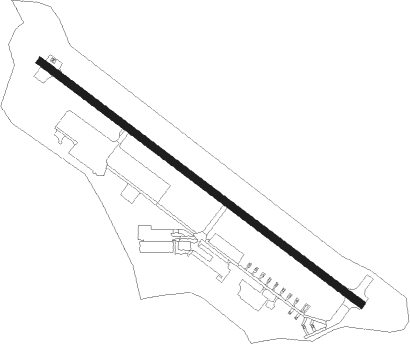
| ILS-cat-I | RW32 | 108.75 | 18.00mi |
| 3.6° GS | RW32 | 108.75 | 18.00mi |
Nearby Points of Interest:
Stele of Bongseon Honggyeongsa
-Anseong Dogi-dong Three-story Stone Pagoda
-Hwaseong Fortress
-Rock-carved triad buddha in Seosan
-Bowonsa
-Buseoksa
-Gongju Seonhwadang
-Sangdang Sanseong
-Former Belgium consulate in Seoul
Nearby beacons
| code | identifier | dist | bearing | frequency |
|---|---|---|---|---|
| PTK | PYONGTAEK VOR/DME | 1 | 303° | 108.20 |
| SOT | SONGTAN VORTAC | 7.9 | 359° | 116.90 |
| SWN | SUWON TACAN | 16.7 | 353° | 108.50 |
| CHO | CHEONGJU VOR/DME | 26.5 | 118° | 109 |
| CHJ | CHEONGJU TACAN | 26.8 | 119° | 110.50 |
| SEL | ANYANG VORTAC | 27.6 | 347° | 115.50 |
| KSM | SEOUL VOR/DME | 29.4 | 9° | 109.80 |
| SOL | SEOUL TACAN | 29.4 | 9° | 111.20 |
| SAN | SEOSAN TACAN | 30.5 | 245° | 111.50 |
| KIP | GIMPO (SEOUL) VOR/DME | 37.5 | 338° | 113.60 |
| WNG | WANGSAN (SEOUL) VOR/DME | 39.7 | 309° | 112.90 |
| JWN | CHOONGWON TACAN | 41.4 | 85° | 111.30 |
| NCN | INCHEON VOR/DME | 43 | 311° | 113.80 |
| YJU | YANGJU VOR/DME | 47.2 | 357° | 114.90 |
| WNJ | WONJU TACAN | 52.6 | 63° | 111.60 |
| HGS | WONJU VOR/DME | 54.6 | 61° | 110.20 |
| CJ | CHUCHON NDB | 64.6 | 37° | 360 |
Instrument approach procedures
| runway | airway (heading) | route (dist, bearing) |
|---|---|---|
| RW32 | KRATT (306°) | KRATT 3200ft |
| RNAV | KRATT 3200ft TIKME (2mi, 305°) 3000ft JOMBA (4mi, 305°) 1900ft GOGVE (2mi, 305°) 1060ft RKSG (3mi, 306°) 94ft (7133mi, 254°) 453ft SUZZZ (7130mi, 74°) NUKKE (12mi, 326°) 3500ft NUKKE (turn) 13500ft |
Disclaimer
The information on this website is not for real aviation. Use this data with the X-Plane flight simulator only! Data taken with kind consent from X-Plane 12 source code and data files. Content is subject to change without notice.