Osan Ab
Airport details
| Country | South Korea |
| State | Gyeonggido |
| Region | RK |
| Airspace | Incheon Ctr |
| Municipality | Pyeongtaek-si |
| Elevation | 40ft (12m) |
| Timezone | GMT +9 |
| Coordinates | 37.09056, 127.02972 |
| Magnetic var | |
| Type | land |
| Available since | X-Plane v10.40 |
| ICAO code | RKSO |
| IATA code | OSN |
| FAA code | n/a |
Communication
| Osan AB ATIS | 132.125 |
| Osan AB Clearance DEL | 127.300 |
| Osan AB Ground Control | 132.450 |
| Osan AB Tower | 122.100 |
| Osan AB Approach | 127.900 |
| Osan AB Departure | 127.900 |
Approach frequencies
| ILS-cat-I | RW09L | 111.3 | 18.00mi |
| ILS-cat-I | RW27R | 111.3 | 18.00mi |
| 3° GS | RW09L | 111.3 | 18.00mi |
| 3° GS | RW27R | 111.3 | 18.00mi |
Nearby Points of Interest:
Stele of Bongseon Honggyeongsa
-Hwaseong Fortress
-Anseong Dogi-dong Three-story Stone Pagoda
-Former Belgium consulate in Seoul
-Myeonje baegab
-Bukhansan Monument
-Rock-carved triad buddha in Seosan
-Park Chung hee's House
-Bowonsa
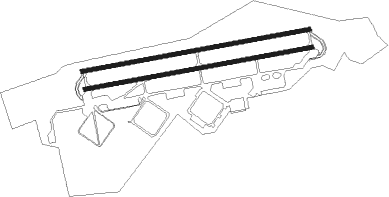
Runway info
Runway 09R / 27L  | ||
| length | 2739m (8986ft) | |
| bearing | 85° / 265° | |
| width | 46m (150ft) | |
| surface | concrete | |
| blast zone | 255m (837ft) / 255m (837ft) | |
| Runway 09L / 27R | ||
| length | 2737m (8980ft) | |
| bearing | 85° / 265° | |
| width | 50m (164ft) | |
| surface | concrete | |
| blast zone | 255m (837ft) / 255m (837ft) | |
Nearby beacons
| code | identifier | dist | bearing | frequency |
|---|---|---|---|---|
| SOT | SONGTAN VORTAC | 0.2 | 27° | 116.90 |
| PTK | PYONGTAEK VOR/DME | 7 | 187° | 108.20 |
| SWN | SUWON TACAN | 9 | 349° | 108.50 |
| SEL | ANYANG VORTAC | 19.9 | 343° | 115.50 |
| KSM | SEOUL VOR/DME | 21.8 | 13° | 109.80 |
| SOL | SEOUL TACAN | 21.8 | 13° | 111.20 |
| KIP | GIMPO (SEOUL) VOR/DME | 30.2 | 333° | 113.60 |
| CHO | CHEONGJU VOR/DME | 31.5 | 129° | 109 |
| CHJ | CHEONGJU TACAN | 31.9 | 129° | 110.50 |
| WNG | WANGSAN (SEOUL) VOR/DME | 34.5 | 301° | 112.90 |
| SAN | SEOSAN TACAN | 34.8 | 235° | 111.50 |
| NCN | INCHEON VOR/DME | 37.5 | 304° | 113.80 |
| YJU | YANGJU VOR/DME | 39.5 | 357° | 114.90 |
| JWN | CHOONGWON TACAN | 41.4 | 94° | 111.30 |
| WNJ | WONJU TACAN | 49 | 70° | 111.60 |
| HGS | WONJU VOR/DME | 50.7 | 68° | 110.20 |
| CJ | CHUCHON NDB | 58.1 | 41° | 360 |
Departure and arrival routes
| Transition altitude | 14000ft |
| Transition level | 14000ft |
| SID end points | distance | outbound heading | |
|---|---|---|---|
| RW09 (ALL) | |||
| DRGGN9 | 20mi | 72° | |
| GOJI1 | 13mi | 129° | |
| MUSTG5 | 25mi | 186° | |
| RW27 (ALL) | |||
| DRGGN9 | 20mi | 72° | |
| GOJI1 | 13mi | 129° | |
| MUSTG5 | 25mi | 186° | |
Instrument approach procedures
| runway | airway (heading) | route (dist, bearing) |
|---|---|---|
| RW09L | JADUB (85°) | JADUB 4000ft |
| RNAV | JADUB 4000ft JERMY (14mi, 85°) 1800ft CASPR (5mi, 85°) 258ft (7128mi, 254°) 441ft JADUB (7112mi, 74°) 4000ft JADUB (turn) 6000ft | |
| RW09R | VISEN (85°) | VISEN 4000ft |
| RNAV | VISEN 4000ft LAGER (5mi, 84°) 3000ft KAYJE (9mi, 85°) 1800ft VOKOT (5mi, 85°) 254ft (7128mi, 254°) 441ft VISEN (7112mi, 74°) 4000ft VISEN (turn) 6000ft | |
| RW27L | STNNN (266°) | STNNN 4000ft |
| RNAV | STNNN 4000ft JINEL (11mi, 266°) 2400ft STOWT (3mi, 265°) 1800ft RKSO (6mi, 265°) 94ft (7129mi, 254°) 1000ft STNNN (7147mi, 74°) 4000ft STNNN (turn) 7000ft | |
| RW27R | AVRIG (265°) | AVRIG 4000ft |
| RNAV | AVRIG 4000ft CELMU (11mi, 266°) 2400ft WONLI (3mi, 265°) 1800ft RKSO (6mi, 264°) 91ft (7129mi, 254°) 441ft AVRIG (7147mi, 74°) 4000ft AVRIG (turn) 7000ft |
Disclaimer
The information on this website is not for real aviation. Use this data with the X-Plane flight simulator only! Data taken with kind consent from X-Plane 12 source code and data files. Content is subject to change without notice.