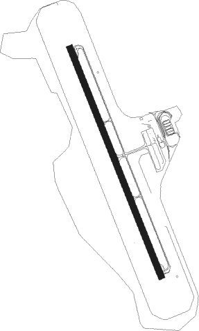
Uljin - Uljin Airport
Airport details
| Country | South Korea |
| State | Uljin-gun |
| Region | RK |
| Airspace | Incheon Ctr |
| Municipality | Giseong-myeon |
| Elevation | 173ft (53m) |
| Timezone | GMT +9 |
| Coordinates | 36.77666, 129.46165 |
| Magnetic var | |
| Type | land |
| Available since | X-Plane v10.40 |
| ICAO code | RKTL |
| IATA code | n/a |
| FAA code | n/a |
Communication
Approach frequencies
| ILS-cat-I | RW35 | 108.1 | 18.00mi |
| ILS-cat-I | RW17 | 108.1 | 18.00mi |
| 3° GS | RW35 | 108.1 | 18.00mi |
| 3° GS | RW17 | 108.1 | 18.00mi |
Nearby beacons
| code | identifier | dist | bearing | frequency |
|---|---|---|---|---|
| UJN | ULJIN VORTAC | 0.2 | 267° | 115.30 |
| NPH | NAVY (POHANG) VORTAC | 47.5 | 184° | 109.60 |
| KPO | POHANG VORTAC | 48 | 179° | 112.50 |
| LC | KANGNUNG NDB | 63.3 | 332° | 257 |
| KAN | KANGNUNG TACAN | 63.7 | 333° | 111.90 |
| KAE | GANGWON VORTAC | 65 | 323° | 115.60 |
| DOC | DONGCHON VOR/DME | 65.7 | 223° | 116.50 |
| TGU | DALSEONG VORTAC | 71.7 | 222° | 112.20 |
Departure and arrival routes
| Transition altitude | 14000ft |
| Transition level | 14000ft |
| SID end points | distance | outbound heading | |
|---|---|---|---|
| RW17 | |||
| LOST6S, LOST2S, LOST1M | 26mi | 184° | |
| NOBU1M, NOBU2S | 22mi | 339° | |
| RW35 | |||
| LOST1R, LOST2N | 26mi | 184° | |
| NOBU1R, NOBU2N | 22mi | 339° | |
| STAR starting points | distance | inbound heading | |
|---|---|---|---|
| RW17 | |||
| LOST1J, LOST2D | 26.4 | 4° | |
| NOBU1J, NOBU2D | 21.5 | 159° | |
| RW35 | |||
| LOST1H, LOST2C | 26.4 | 4° | |
| NOBU1H, NOBU2C | 21.5 | 159° | |
Instrument approach procedures
| runway | airway (heading) | route (dist, bearing) |
|---|---|---|
| RW17 | ALDON (217°) | ALDON 6000ft TL041 (5mi, 284°) 4500ft UMNAE (5mi, 256°) 3200ft |
| RNAV | UMNAE 3200ft TL043 (5mi, 159°) 2000ft RKTL (5mi, 159°) 226ft TL045 (5mi, 159°) BANYA (9mi, 99°) 6000ft BANYA (turn) 6000ft | |
| RW35 | BANYA (297°) | BANYA 6000ft TL051 (3mi, 226°) 5000ft HUPHO (5mi, 256°) 3400ft |
| RW35 | LIDPA (339°) | LIDPA 5000ft HUPHO (5mi, 339°) 3400ft |
| RNAV | HUPHO 3400ft TL053 (6mi, 339°) 1800ft RKTL (5mi, 339°) 208ft TL055 (5mi, 339°) ALDON (9mi, 61°) 6000ft ALDON (turn) 6000ft |
Holding patterns
| STAR name | hold at | type | turn | heading* | altitude | leg | speed limit |
|---|---|---|---|---|---|---|---|
| LOST1H | BANYA | VHF | left | 130 (310)° | 6000ft - 6000ft | 1.0min timed | 230 |
| LOST1J | ALDON | VHF | left | 40 (220)° | 6000ft - 6000ft | 1.0min timed | 230 |
| LOST2C | BANYA | VHF | left | 130 (310)° | 6000ft - 6000ft | 1.0min timed | 230 |
| LOST2D | ALDON | VHF | left | 40 (220)° | 6000ft - 6000ft | 1.0min timed | 230 |
| NOBU1H | BANYA | VHF | left | 130 (310)° | 6000ft - 6000ft | 1.0min timed | 230 |
| NOBU1J | ALDON | VHF | left | 40 (220)° | 6000ft - 6000ft | 1.0min timed | 230 |
| NOBU2C | BANYA | VHF | left | 130 (310)° | 6000ft - 6000ft | 1.0min timed | 230 |
| NOBU2D | ALDON | VHF | left | 40 (220)° | 6000ft - 6000ft | 1.0min timed | 230 |
| *) magnetic outbound (inbound) holding course | |||||||
Disclaimer
The information on this website is not for real aviation. Use this data with the X-Plane flight simulator only! Data taken with kind consent from X-Plane 12 source code and data files. Content is subject to change without notice.
