Seosan - Seosan Ab
Airport details
| Country | South Korea |
| State | Chungcheongnamdo |
| Region | RK |
| Airspace | Incheon Ctr |
| Municipality | Seosan-si |
| Elevation | 39ft (12m) |
| Timezone | GMT +9 |
| Coordinates | 36.70167, 126.49167 |
| Magnetic var | |
| Type | land |
| Available since | X-Plane v10.40 |
| ICAO code | RKTP |
| IATA code | HMY |
| FAA code | n/a |
Communication
| Seosan AB ATIS | 130.300 |
| Seosan AB HAEMI Tower | 126.200 |
| Seosan AB HAEMI Tower | 136.775 |
| Seosan AB HAEMI Approach | 124.600 |
| Seosan AB Departure | 124.600 |
Nearby Points of Interest:
Bowonsa
-Rock-carved triad buddha in Seosan
-Buseoksa
Runway info
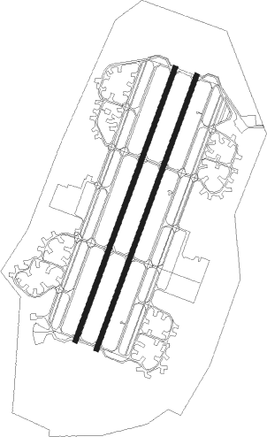
Runway 03L / 21R  | ||
| length | 2733m (8967ft) | |
| bearing | 30° / 210° | |
| width | 46m (150ft) | |
| surface | concrete | |
| blast zone | 255m (837ft) / 255m (837ft) | |
| Runway 03R / 21L | ||
| length | 2737m (8980ft) | |
| bearing | 30° / 210° | |
| width | 46m (150ft) | |
| surface | concrete | |
| blast zone | 255m (837ft) / 255m (837ft) | |
Nearby beacons
| code | identifier | dist | bearing | frequency |
|---|---|---|---|---|
| SAN | SEOSAN TACAN | 0.6 | 307° | 111.50 |
| PTK | PYONGTAEK VOR/DME | 30 | 63° | 108.20 |
| SOT | SONGTAN VORTAC | 35 | 54° | 116.90 |
| SWN | SUWON TACAN | 40.5 | 43° | 108.50 |
| WNG | WANGSAN (SEOUL) VOR/DME | 43.9 | 357° | 112.90 |
| SEL | ANYANG VORTAC | 47.6 | 32° | 115.50 |
| NCN | INCHEON VOR/DME | 47.7 | 356° | 113.80 |
| KUZ | KUNSAN VORTAC | 47.8 | 171° | 112.80 |
| KIP | GIMPO (SEOUL) VOR/DME | 53.3 | 19° | 113.60 |
| KSM | SEOUL VOR/DME | 53.7 | 40° | 109.80 |
| SOL | SEOUL TACAN | 53.7 | 40° | 111.20 |
Disclaimer
The information on this website is not for real aviation. Use this data with the X-Plane flight simulator only! Data taken with kind consent from X-Plane 12 source code and data files. Content is subject to change without notice.