Cheongju - Cheongju Intl
Airport details
| Country | South Korea |
| State | Chungcheongbugdo |
| Region | RK |
| Airspace | Incheon Ctr |
| Municipality | Cheongju-si |
| Elevation | 187ft (57m) |
| Timezone | GMT +9 |
| Coordinates | 36.71639, 127.49917 |
| Magnetic var | |
| Type | land |
| Available since | X-Plane v10.40 |
| ICAO code | RKTU |
| IATA code | CJJ |
| FAA code | n/a |
Communication
| Cheongju Intl Cheongju INTL Airport | 128.850 |
| Cheongju Intl Cheongju Ground Control | 121.875 |
| Cheongju Intl Cheongju Tower | 126.200 |
| Cheongju Intl Cheongju Tower | 118.700 |
| Cheongju Intl JUNGWON Approach | 134.400 |
| Cheongju Intl Jungwon Approach | 134.100 |
| Cheongju Intl JUNGWON Approach | 134.000 |
| Cheongju Intl JUNGWON Departure | 129.650 |
Approach frequencies
| ILS-cat-I | RW24R | 111.7 | 18.00mi |
| ILS-cat-I | RW06L | 110.3 | 18.00mi |
| 3° GS | RW24R | 111.7 | 18.00mi |
| 3° GS | RW06L | 110.3 | 18.00mi |
Nearby Points of Interest:
Sangdang Sanseong
-Jeongipumsong Pine Tree
-Anseong Dogi-dong Three-story Stone Pagoda
-Stele of Bongseon Honggyeongsa
-Songnisan
-Gongju Seonhwadang
-Seven-storied stone pagoda in Tappyeong-ri
-Beobcheonsa temple site
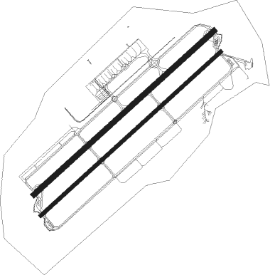
Runway info
Runway 06L / 24R  | ||
| length | 2742m (8996ft) | |
| bearing | 58° / 238° | |
| width | 61m (200ft) | |
| surface | concrete | |
| blast zone | 255m (837ft) / 255m (837ft) | |
| Runway 06R / 24L | ||
| length | 2742m (8996ft) | |
| bearing | 58° / 238° | |
| width | 46m (150ft) | |
| surface | concrete | |
| blast zone | 255m (837ft) / 255m (837ft) | |
Nearby beacons
| code | identifier | dist | bearing | frequency |
|---|---|---|---|---|
| CHO | CHEONGJU VOR/DME | 0.2 | 288° | 109 |
| CHJ | CHEONGJU TACAN | 0.4 | 213° | 110.50 |
| JWN | CHOONGWON TACAN | 26.7 | 51° | 111.30 |
| PTK | PYONGTAEK VOR/DME | 27.8 | 298° | 108.20 |
| SOT | SONGTAN VORTAC | 31.9 | 309° | 116.90 |
| SWN | SUWON TACAN | 39.4 | 316° | 108.50 |
| CUN | YECHEON VOR/DME | 40.1 | 96° | 114.80 |
| YCN | YECHEON TACAN | 42 | 95° | 108.90 |
| YC | YECHON NDB | 42.4 | 96° | 367 |
| KSM | SEOUL VOR/DME | 47.7 | 332° | 109.80 |
| SOL | SEOUL TACAN | 47.7 | 332° | 111.20 |
| WNJ | WONJU TACAN | 48.3 | 33° | 111.60 |
| SEL | ANYANG VORTAC | 50 | 321° | 115.50 |
| HGS | WONJU VOR/DME | 50.9 | 32° | 110.20 |
| KIP | GIMPO (SEOUL) VOR/DME | 60.8 | 320° | 113.60 |
| KUZ | KUNSAN VORTAC | 64.7 | 228° | 112.80 |
Departure and arrival routes
| Transition altitude | 14000ft |
| Transition level | 14000ft |
| SID end points | distance | outbound heading | |
|---|---|---|---|
| RW06 (ALL) | |||
| CHO1D | 23mi | 130° | |
| CHO7 | 24mi | 272° | |
| RW06L | |||
| BUKIL2 | 24mi | 272° | |
| BUKIL1 | 10mi | 309° | |
| RW24 (ALL) | |||
| CHO1D | 23mi | 130° | |
| CHO8 | 24mi | 272° | |
| RW24R | |||
| UPTIL1 | 24mi | 272° | |
| OLREG1 | 10mi | 309° | |
Instrument approach procedures
| runway | airway (heading) | route (dist, bearing) |
|---|---|---|
| RW06L | JIKJI (280°) | JIKJI 7000ft ASORA (9mi, 277°) 6000ft OSIVI (5mi, 277°) 6000ft SURSO (5mi, 277°) 6000ft TU761 (8mi, 238°) 5000ft BAKJO (8mi, 136°) 4400ft |
| RNAV | BAKJO 4400ft TU762 (3mi, 58°) 3900ft TU763 (3mi, 58°) 3000ft SAPUX (3mi, 58°) 2100ft TU766 (3mi, 58°) 1200ft YEJEE (2mi, 58°) 642ft IKISO (15mi, 58°) ESBOS (6mi, 136°) 6000ft IKAPO (7mi, 196°) JIKJI (5mi, 280°) 7000ft JIKJI (turn) 7000ft | |
| RW24R | HYEIN (207°) | HYEIN 6000ft TURTU (8mi, 136°) 3700ft |
| RW24R | IKAPO (280°) | IKAPO 7000ft MENOL (7mi, 15°) 6000ft TURTU (5mi, 316°) 3700ft |
| RNAV | TURTU 3700ft TU743 (6mi, 238°) 2500ft APAKI (2mi, 238°) 2100ft TU746 (3mi, 238°) 1200ft SURAX (2mi, 238°) 508ft KADEV (4mi, 238°) COWON (8mi, 256°) 6000ft COWON (turn) 6000ft |
Holding patterns
| STAR name | hold at | type | turn | heading* | altitude | leg | speed limit |
|---|---|---|---|---|---|---|---|
| MATIZ1 | JIKJI | VHF | right | 110 (290)° | > 7000ft | DME 5.0mi | 230 |
| *) magnetic outbound (inbound) holding course | |||||||
Disclaimer
The information on this website is not for real aviation. Use this data with the X-Plane flight simulator only! Data taken with kind consent from X-Plane 12 source code and data files. Content is subject to change without notice.