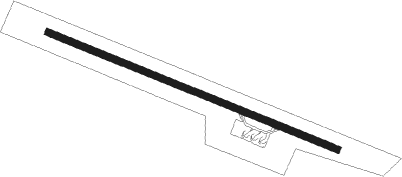
Butuan City - Butuan
Airport details
| Country | Philippines |
| State | Agusan del Norte Province |
| Region | RP |
| Airspace | Manila Ctr |
| Municipality | Butuan |
| Elevation | 141ft (43m) |
| Timezone | GMT +8 |
| Coordinates | 8.95185, 125.47812 |
| Magnetic var | |
| Type | land |
| Available since | X-Plane v10.40 |
| ICAO code | RPME |
| IATA code | BXU |
| FAA code | n/a |
Communication
| Butuan CTAF | 121.900 |
| Butuan Tower | 123.200 |
| Butuan Tower | 122.000 |
| Butuan APCH | 121.300 |
Nearby beacons
| code | identifier | dist | bearing | frequency |
|---|---|---|---|---|
| BN | BUTUAN VOR/DME | 0.3 | 88° | 112.50 |
Departure and arrival routes
| Transition altitude | 11000ft |
| Transition level | 13000ft |
| SID end points | distance | outbound heading | |
|---|---|---|---|
| RW12 | |||
| BAMP1A | 44mi | 313° | |
| KAWI1A | 44mi | 332° | |
| TACL1A | 44mi | 360° | |
| RW30 | |||
| BAMP1B | 44mi | 313° | |
| KAWI1B | 44mi | 332° | |
| TACL1B | 44mi | 360° | |
| STAR starting points | distance | inbound heading | |
|---|---|---|---|
| RW12 | |||
| BAMP2A | 43.9 | 133° | |
| KAWI2A | 44.1 | 152° | |
| TACL2A | 44.4 | 180° | |
| RW30 | |||
| BAMP2B | 43.9 | 133° | |
| KAWI2B | 44.1 | 152° | |
| TACL2B | 44.4 | 180° | |
Instrument approach procedures
| runway | airway (heading) | route (dist, bearing) |
|---|---|---|
| RW12 | MERLI (123°) | MERLI 2500ft ME406 (5mi, 140°) 2500ft |
| RW12 | RALAS (136°) | RALAS 2500ft ME406 (5mi, 197°) 2500ft |
| RNAV | ME406 2500ft ME408 (5mi, 116°) 2500ft RPME (8mi, 116°) 77ft (7506mi, 266°) 1000ft NACOR (7505mi, 86°) RALAS (10mi, 284°) 2500ft | |
| RW30 | TUBAY (154°) | TUBAY 3500ft LINGA (14mi, 125°) BENTO (12mi, 125°) 3500ft ME506 (5mi, 206°) 3400ft |
| RNAV | ME506 3400ft ME508 (5mi, 296°) 2700ft RPME (9mi, 296°) 95ft (7506mi, 266°) 1000ft TUBAY (7498mi, 86°) 3500ft |
Holding patterns
| STAR name | hold at | type | turn | heading* | altitude | leg | speed limit |
|---|---|---|---|---|---|---|---|
| BAMP2A | JARED | VHF | left | 321 (141)° | 10000ft - 14000ft | 1.0min timed | 230 |
| BAMP2B | JARED | VHF | left | 321 (141)° | 10000ft - 14000ft | 1.0min timed | 230 |
| BAMP2B | TUBAY | VHF | left | 306 (126)° | 3500ft - 10000ft | 1.0min timed | 230 |
| KAWI2A | BULAD | VHF | left | 350 (170)° | 10000ft - 14000ft | 1.0min timed | 230 |
| KAWI2B | BULAD | VHF | left | 350 (170)° | 10000ft - 14000ft | 1.0min timed | 230 |
| KAWI2B | TUBAY | VHF | left | 306 (126)° | 3500ft - 10000ft | 1.0min timed | 230 |
| TACL2A | RALAS | VHF | right | 17 (197)° | 2500ft - 10000ft | 1.0min timed | 230 |
| TACL2A | ROLEX | VHF | left | 17 (197)° | 10000ft - 14000ft | 1.0min timed | 230 |
| TACL2B | ROLEX | VHF | left | 17 (197)° | 10000ft - 14000ft | 1.0min timed | 230 |
| TACL2B | TUBAY | VHF | left | 306 (126)° | 3500ft - 10000ft | 1.0min timed | 230 |
| *) magnetic outbound (inbound) holding course | |||||||
Disclaimer
The information on this website is not for real aviation. Use this data with the X-Plane flight simulator only! Data taken with kind consent from X-Plane 12 source code and data files. Content is subject to change without notice.
