Cagayan De Oro City - Cagayan De Oro
Airport details
| Country | Philippines |
| State | Misamis Oriental Province |
| Region | RP |
| Airspace | Manila Ctr |
| Municipality | Cagayan de Oro |
| Elevation | 601ft (183m) |
| Timezone | GMT +8 |
| Coordinates | 8.41621, 124.61136 |
| Magnetic var | |
| Type | land |
| Available since | X-Plane v10.40 |
| ICAO code | RPML |
| IATA code | CGY |
| FAA code | n/a |
Communication
| Cagayan De Oro Tower | 127.900 |
| Cagayan De Oro Approach | 122.300 |
| Cagayan De Oro Approach | 123.600 |
Nearby Points of Interest:
Jasaan Church
-Kitanglad Mountain Range
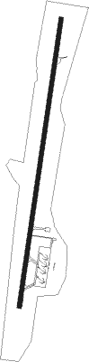
Runway info
| Runway 01 / 19 | ||
| length | 2469m (8100ft) | |
| bearing | 13° / 193° | |
| width | 36m (118ft) | |
| surface | asphalt | |
| displ threshold | 131m (430ft) / 0m (0ft) | |
Nearby beacons
| code | identifier | dist | bearing | frequency |
|---|---|---|---|---|
| LGD | LAGUINDINGAN VOR/DME | 15.1 | 321° | 116.10 |
| OZ | OZAMIS NDB | 48.4 | 253° | 267 |
| BN | BUTUAN VOR/DME | 60.9 | 58° | 112.50 |
Disclaimer
The information on this website is not for real aviation. Use this data with the X-Plane flight simulator only! Data taken with kind consent from X-Plane 12 source code and data files. Content is subject to change without notice.