Baguio City - Baguio
Airport details
| Country | Philippines |
| State | Benguet Province |
| Region | RP |
| Airspace | Manila Ctr |
| Municipality | Baguio |
| Elevation | 4250ft (1295m) |
| Timezone | GMT +8 |
| Coordinates | 16.37509, 120.61894 |
| Magnetic var | |
| Type | land |
| Available since | X-Plane v10.40 |
| ICAO code | RPUB |
| IATA code | BAG |
| FAA code | n/a |
Communication
| Baguio CTAF | 121.900 |
| Baguio Baguio Twr | 123.500 |
Nearby Points of Interest:
Mount Pulag National Park
-Casa Real
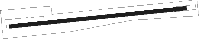
Runway info
| Runway 09 / 27 | ||
| length | 1682m (5518ft) | |
| bearing | 89° / 269° | |
| width | 35m (114ft) | |
| surface | concrete | |
Nearby beacons
| code | identifier | dist | bearing | frequency |
|---|---|---|---|---|
| BG | BAGUIO NDB | 0.1 | 253° | 272 |
| BA | BAGABANG NDB | 39.3 | 69° | 339 |
| CAB | CABANATUAN VOR/DME | 58.5 | 156° | 112.70 |
Disclaimer
The information on this website is not for real aviation. Use this data with the X-Plane flight simulator only! Data taken with kind consent from X-Plane 12 source code and data files. Content is subject to change without notice.