Chelan - Lake Chelan
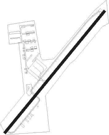
Airport details
| Country | United States of America |
| State | Washington |
| Region | K1 |
| Airspace | Seattle Ctr |
| Municipality | Chelan |
| Elevation | 1263ft (385m) |
| Timezone | GMT -8 |
| Coordinates | 47.86601, -119.94270 |
| Magnetic var | |
| Type | land |
| Available since | X-Plane v10.40 |
| ICAO code | S10 |
| IATA code | n/a |
| FAA code | S10 |
Communication
| Lake Chelan CTAF | 122.900 |
Nearby Points of Interest:
Gallaher House
-Douglas County Courthouse
-Columbia River Bridge
-Chelan Butte Lookout
-Badger Mountain Lookout
-Fort Okanogan
-Withrow Moraine and Jameson Lake Drumlin Field
-Sims Corner Eskers and Kames
Nearby beacons
| code | identifier | dist | bearing | frequency |
|---|---|---|---|---|
| EAT | WENATCHEE VOR/DME | 30 | 210° | 111 |
| EPH | EPHRATA VORTAC | 36 | 133° | 112.60 |
| MWH | MOSES LAKE VOR/DME | 46.8 | 136° | 115 |
| MW | PELLY (MOSES LAKE) NDB | 52.5 | 138° | 408 |
| ELN | ELLENSBURG (ELLENSBERG) VOR/DME | 54.7 | 211° | 117.90 |
Disclaimer
The information on this website is not for real aviation. Use this data with the X-Plane flight simulator only! Data taken with kind consent from X-Plane 12 source code and data files. Content is subject to change without notice.