Emmett - Emmett Municipal
Airport details
| Country | United States of America |
| State | Idaho |
| Region | K1 |
| Airspace | Salt Lake City Ctr |
| Municipality | Emmett |
| Elevation | 2354ft (717m) |
| Timezone | GMT -7 |
| Coordinates | 43.85265, -116.53907 |
| Magnetic var | |
| Type | land |
| Available since | X-Plane v10.40 |
| ICAO code | S78 |
| IATA code | n/a |
| FAA code | n/a |
Communication
| Emmett Municipal CTAF | 122.900 |
Nearby Points of Interest:
Emmett Presbyterian Church
-Gem County Courthouse
-Firebird Raceway
-Star Camp
-Eagle Adventist Schoolhouse
-Sweet Methodist Episcopal Church
-Boise River and Canal Bridge
-O. F. Short House
-Aiken's Hotel
-Orville Jackson House
-Caldwell Odd Fellow Home for the Aged
-A. K. Steunenberg House
-North Caldwell Historic District
-Caldwell Historic District
-U.S. Post Office – Caldwell Main
-MacMillan Chapel
-Caldwell Carnegie Library
-St. Mary's Catholic Church
-F. F. Beale House
-Sterry Hall
-Blatchley Hall
-Carrie Adell Strahorn Memorial Library
-Henry W. and Ida Frost Dorman House
-New Plymouth Congregational Church
-Pierce–Borah House
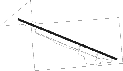
Runway info
| Runway 10 / 28 | ||
| length | 947m (3107ft) | |
| bearing | 110° / 290° | |
| width | 17m (55ft) | |
| surface | asphalt | |
| displ threshold | 0m (0ft) / 110m (361ft) | |
| blast zone | 58m (190ft) / 0m (0ft) | |
Nearby beacons
| code | identifier | dist | bearing | frequency |
|---|---|---|---|---|
| BOI | BOISE VORTAC | 23.4 | 131° | 113.30 |
| DNJ | DONNELLY (MC CALL) VOR/DME | 56.7 | 20° | 116.20 |
| MUO | MOUNTAIN HOME TACAN | 56.7 | 141° | 114 |
| LIA | LIBERATOR VOR | 61.9 | 139° | 114.90 |
Disclaimer
The information on this website is not for real aviation. Use this data with the X-Plane flight simulator only! Data taken with kind consent from X-Plane 12 source code and data files. Content is subject to change without notice.