Weiser - Weiser Municipal Airport
Airport details
| Country | United States of America |
| State | Idaho |
| Region | K1 |
| Airspace | Salt Lake City Ctr |
| Municipality | Washington County |
| Elevation | 2120ft (646m) |
| Timezone | GMT -7 |
| Coordinates | 44.20467, -116.96053 |
| Magnetic var | |
| Type | land |
| Available since | X-Plane v10.40 |
| ICAO code | S87 |
| IATA code | n/a |
| FAA code | n/a |
Communication
| Weiser Municipal Airport CTAF | 122.800 |
Nearby Points of Interest:
Knights of Pythias Lodge Hall
-Washington County Courthouse
-B. S. Varian House
-Anderson–Elwell House
-Morris Sommer House
-Benjamin Watlington House
-James M. Fisher House
-Intermountain Institute
-Grant Whitney House
-Payette City Hall and Courthouse
-Coughanour Apartment Block
-Oregon Short Line Railroad Depot
-James Rowley and Mary J. Blackaby House
-New Plymouth Congregational Church
-Oregon Commercial Company Building
-Vale Drug Store
-First Bank of Vale
-Rinehart Stone House Museum
-Vale Hotel and Grand Opera House
-Green Lantern Saloon
-Al Thompson and Son's Feed and Seed Company
-Fort Boise
-Salubria Lodge No. 31
-Wilson House
-Gem County Courthouse
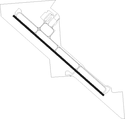
Runway info
| Runway 12 / 30 | ||
| length | 1218m (3996ft) | |
| bearing | 127° / 307° | |
| width | 18m (60ft) | |
| surface | asphalt | |
Nearby beacons
| code | identifier | dist | bearing | frequency |
|---|---|---|---|---|
| DNJ | DONNELLY (MC CALL) VOR/DME | 46.7 | 53° | 116.20 |
| BOI | BOISE VORTAC | 51.3 | 130° | 113.30 |
| BKE | BAKER CITY VOR/DME | 52.6 | 307° | 115.30 |
Instrument approach procedures
| runway | airway (heading) | route (dist, bearing) |
|---|---|---|
| RWNVA | EMETT (312°) | EMETT WUVOK (10mi, 318°) 4400ft |
| RNAV | WUVOK 4400ft GACEP (6mi, 307°) 4000ft S87 (6mi, 307°) 2170ft FOVAK (7mi, 306°) HOVEL (7mi, 301°) 9000ft HOVEL (turn) |
Disclaimer
The information on this website is not for real aviation. Use this data with the X-Plane flight simulator only! Data taken with kind consent from X-Plane 12 source code and data files. Content is subject to change without notice.