Garrett - Martin Fld
Airport details
| Country | United States of America |
| State | Washington |
| Region | K1 |
| Airspace | Seattle Ctr |
| Municipality | Walla Walla County |
| Elevation | 746ft (227m) |
| Timezone | GMT -8 |
| Coordinates | 46.04694, -118.41718 |
| Magnetic var | |
| Type | land |
| Available since | X-Plane v10.40 |
| ICAO code | S95 |
| IATA code | n/a |
| FAA code | n/a |
Communication
| Martin Fld CTAF/UNICOM | 122.800 |
Nearby Points of Interest:
Whitman Mission National Historic Site
-Fort Walla Walla
-Walla Walla Valley Traction Company Car Barn
-Kirkman House
-Adams Odd Fellows Hall
-Greasewood Finnish Apostolic Lutheran Church
-Wallula Gap
-Masonic Temple
-John F. Kilkenny United States Post Office and Courthouse
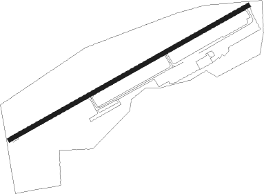
Runway info
| Runway 5 / 23 | ||
| length | 1159m (3802ft) | |
| bearing | 72° / 252° | |
| width | 18m (60ft) | |
| surface | asphalt | |
Nearby beacons
| code | identifier | dist | bearing | frequency |
|---|---|---|---|---|
| ALW | WALLA WALLA VOR/DME | 5.7 | 72° | 116.40 |
| AL | TRINA (WALLA WALLA) NDB | 12 | 60° | 353 |
| PDT | PENDLETON VORTAC | 30.2 | 236° | 114.70 |
| PSC | PASCO VOR/DME | 32 | 288° | 109.80 |
| LGD | LA GRANDE NDB | 46.4 | 147° | 296 |
Disclaimer
The information on this website is not for real aviation. Use this data with the X-Plane flight simulator only! Data taken with kind consent from X-Plane 12 source code and data files. Content is subject to change without notice.