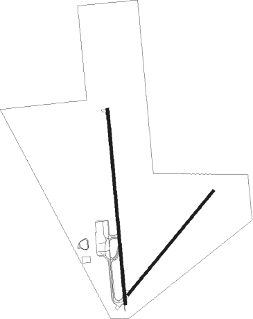
Cordoba - Ing Ambrosio Taravella
Airport details
| Country | Argentina |
| State | Córdoba |
| Region | SA |
| Airspace | Cordoba Ctr |
| Municipality | Cordoba |
| Elevation | 1604ft (489m) |
| Timezone | GMT -3 |
| Coordinates | -31.31000, -64.20834 |
| Magnetic var | |
| Type | land |
| Available since | X-Plane v10.32 |
| ICAO code | SACO |
| IATA code | COR |
| FAA code | n/a |
Communication
| Ing Ambrosio Taravella ATIS | 127.500 |
| Ing Ambrosio Taravella Ground Control | 121.750 |
| Ing Ambrosio Taravella Tower | 118.300 |
Approach frequencies
| ILS-cat-I | RW19 | 110.3 | 18.00mi |
| 3° GS | RW19 | 110.3 | 18.00mi |
Nearby beacons
| code | identifier | dist | bearing | frequency |
|---|---|---|---|---|
| CBA | CORDOBA VOR/DME | 0.3 | 125° | 114.50 |
| H | ING AER A L V TARAVELLA(CORDOB NDB | 1.4 | 359° | 262 |
| LDR | VILLA DOLORES NDB | 61.4 | 235° | 310 |
Departure and arrival routes
| Transition altitude | 3500ft |
| SID end points | distance | outbound heading | |
|---|---|---|---|
| RW01 | |||
| IRAVO1 | 55mi | 58° | |
| GENAS1 | 55mi | 98° | |
| ASEMI1 | 55mi | 124° | |
| RW19 | |||
| IRAVO1 | 55mi | 58° | |
| GENAS1 | 55mi | 98° | |
| ASEMI1 | 55mi | 124° | |
| STAR starting points | distance | inbound heading | |
|---|---|---|---|
| RW05 | |||
| ALDE1X | 54.8 | 70° | |
| PAMA1X | 54.6 | 86° | |
| ETEP1X | 54.7 | 126° | |
| SIBO1X | 54.8 | 150° | |
| DONK1X | 54.9 | 168° | |
| LOGE1X | 54.9 | 178° | |
| TREJ1X | 55.0 | 238° | |
| GEMO1X | 55.1 | 254° | |
| MAVB1X | 55.1 | 267° | |
| GENA1X | 55.1 | 278° | |
| ASIS1X | 55.2 | 290° | |
| SIME1X | 55.3 | 319° | |
Instrument approach procedures
| runway | airway (heading) | route (dist, bearing) |
|---|---|---|
| RW01 | PAGAR (290°) | PAGAR ILPEN (10mi, 272°) 3500ft ESONA (6mi, 270°) 3500ft |
| RNAV | ESONA 3500ft LIVUS (4mi, 325°) 2500ft SACO (4mi, 359°) 1576ft CO128 (3mi, 359°) CO129 (8mi, 89°) DEVEB (11mi, 67°) DEVEB (turn) | |
| RW05 | IRETI (179°) | IRETI CO009 (20mi, 229°) CO008 (5mi, 140°) GUVUX (3mi, 130°) |
| RNAV | GUVUX CO006 (5mi, 49°) 3500ft ESUBO (2mi, 49°) 3500ft SACO (7mi, 43°) 1577ft (4095mi, 64°) 2010ft CBA (4094mi, 244°) (4094mi, 64°) | |
| RW19 | KOVEV (179°) | KOVEV 4400ft AGUAD (5mi, 179°) 4400ft |
| RW19 | RIQUE (290°) | RIQUE CO528 (12mi, 310°) XONEN (14mi, 310°) PUPAT (6mi, 310°) 4400ft AGUAD (5mi, 264°) 4400ft |
| RNAV | AGUAD 4400ft RAXOB (5mi, 179°) 3000ft SACO (5mi, 179°) 1659ft LOKOT (10mi, 135°) LOKOT (turn) | |
| RW23 | RIQUE (290°) | RIQUE CO528 (12mi, 310°) NUXAB (7mi, 310°) 4000ft RENUK (8mi, 305°) 4000ft |
| RNAV | RENUK 4000ft SILAV (5mi, 228°) 3000ft SACO (5mi, 235°) 1597ft LOKOT (10mi, 135°) LOKOT (turn) |
Holding patterns
| STAR name | hold at | type | turn | heading* | altitude | leg | speed limit |
|---|---|---|---|---|---|---|---|
| ALDE1X | IRETI | VHF | left | 20 (200)° | > 6000ft | DME 4.0mi | 210 |
| ASIS1X | IRETI | VHF | left | 20 (200)° | > 6000ft | DME 4.0mi | 210 |
| DONK1X | IRETI | VHF | left | 20 (200)° | > 6000ft | DME 4.0mi | 210 |
| ETEP1X | IRETI | VHF | left | 20 (200)° | > 6000ft | DME 4.0mi | 210 |
| GEMO1X | IRETI | VHF | left | 20 (200)° | > 6000ft | DME 4.0mi | 210 |
| GENA1X | IRETI | VHF | left | 20 (200)° | > 6000ft | DME 4.0mi | 210 |
| LOGE1X | IRETI | VHF | left | 20 (200)° | > 6000ft | DME 4.0mi | 210 |
| MAVB1X | IRETI | VHF | left | 20 (200)° | > 6000ft | DME 4.0mi | 210 |
| PAMA1X | IRETI | VHF | left | 20 (200)° | > 6000ft | DME 4.0mi | 210 |
| SIBO1X | IRETI | VHF | left | 20 (200)° | > 6000ft | DME 4.0mi | 210 |
| SIME1X | IRETI | VHF | left | 20 (200)° | > 6000ft | DME 4.0mi | 210 |
| TREJ1X | IRETI | VHF | left | 20 (200)° | > 6000ft | DME 4.0mi | 210 |
| *) magnetic outbound (inbound) holding course | |||||||
Disclaimer
The information on this website is not for real aviation. Use this data with the X-Plane flight simulator only! Data taken with kind consent from X-Plane 12 source code and data files. Content is subject to change without notice.

