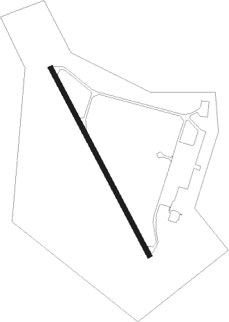
El Palomar
Airport details
| Country | Argentina |
| State | Buenos Aires |
| Region | SA |
| Airspace | Ezeiza Ctr |
| Municipality | El Palomar |
| Elevation | 59ft (18m) |
| Timezone | GMT -3 |
| Coordinates | -34.60603, -58.60072 |
| Magnetic var | |
| Type | land |
| Available since | X-Plane v10.40 |
| ICAO code | SADP |
| IATA code | EPA |
| FAA code | n/a |
Communication
| El Palomar Palomar Tower AUX | 118.900 |
| El Palomar Palomar Tower | 120.300 |
Approach frequencies
| ILS-cat-I | RW17 | 110.5 | 18.00mi |
| 3° GS | RW17 | 110.5 | 18.00mi |
Nearby Points of Interest:
Depósito de Gravitación de Villa Devoto
-Administración de los Mataderos
-Olimpo
-puente de Marquez
-Casa Marcó del Pont
-Café San Bernardo
-Navy Petty-Officers School of Mechanics
-Plaza Primera Junta
-Quinta presidencial de Olivos
-Ciudad Evita
-Central Military Hospital
-Mariano Acosta school
-Buenos Aires Cricket Club Ground
-Puente Valentín Alsina
-Palacio Errázuriz
-Café de los Angelitos
-Palacio Dassen
-El Gato Negro
-Congressional Plaza
-Café La Biela
-Virrey Cevallos
-Fernández Anchorena Palace
-Petit Colón
-Confederación General Económica
Nearby beacons
| code | identifier | dist | bearing | frequency |
|---|---|---|---|---|
| PAL | EL PALOMAR (BUENOS AIRES) VOR/DME | 0.7 | 247° | 115.20 |
| P | JORGE NEWBERY AEROPARQUE(BUENO NDB | 8.7 | 70° | 280 |
| FDO | SAN FERNANDO VOR/DME | 9.3 | 6° | 114.40 |
| ENO | MARIANO MORENO VOR/DME | 9.7 | 283° | 112.90 |
| N | JORGE NEWBERY AEROPARQUE(BUENO NDB | 11.5 | 85° | 375 |
| OC | EZEIZA INTL MINISTRO PISTARINI NDB | 12 | 189° | 330 |
| C | EZEIZA INTL MINISTRO PISTARINI NDB | 12.7 | 170° | 305 |
| EZE | EZEIZA VOR/DME | 13.4 | 163° | 116.50 |
| OA | EZEIZA INTL MINISTRO PISTARINI NDB | 17.7 | 162° | 270 |
| ILM | QUILMES NDB | 18.8 | 106° | 210 |
| PTA | LA PLATA NDB | 40.8 | 117° | 250 |
| PTA | LA PLATA VOR | 41.1 | 118° | 113.70 |
| SNT | SAN ANTONIO DE ARECO VOR/DME | 47.6 | 295° | 117.70 |
Departure and arrival routes
| Transition altitude | 3000ft |
| STAR starting points | distance | inbound heading | |
|---|---|---|---|
| RW17 | |||
| VALO8C | 63.0 | 41° | |
| ASAD7C | 56.4 | 68° | |
| SNT7C | 47.6 | 115° | |
| PAGO7C | 41.5 | 170° | |
| KUKE1C | 31.7 | 222° | |
| PAPI1C | 31.8 | 252° | |
| SURB7A | 33.0 | 256° | |
| UGIM7C | 87.6 | 282° | |
| KOVU7C | 64.0 | 299° | |
| TENI7C | 67.6 | 321° | |
| GBE7C | 69.0 | 353° | |
Instrument approach procedures
| runway | airway (heading) | route (dist, bearing) |
|---|---|---|
| RW17 | VANAR (150°) | VANAR DP476 (8mi, 152°) 2500ft |
| RNAV | DP476 2500ft DP376 (3mi, 153°) 2300ft SADP (8mi, 147°) 91ft DP092 (turn) DP576 (4mi, 114°) PAL (5mi, 298°) 3000ft PAL (turn) 3000ft |
Holding patterns
| STAR name | hold at | type | turn | heading* | altitude | leg | speed limit |
|---|---|---|---|---|---|---|---|
| ASAD7C | VANAR | VHF | right | 319 (139)° | > 5000ft | 1.0min timed | 210 |
| GBE7C | VANAR | VHF | right | 319 (139)° | > 5000ft | 1.0min timed | 210 |
| KOVU7C | PTA | NDB | right | 97 (277)° | > 12000ft | 1.0min timed | ICAO rules |
| KOVU7C | VANAR | VHF | right | 319 (139)° | > 5000ft | 1.0min timed | 210 |
| KUKE1C | KUKEN | VHF | right | 44 (224)° | < 60000ft | 1.0min timed | ICAO rules |
| KUKE1C | VANAR | VHF | right | 319 (139)° | > 5000ft | 1.0min timed | 210 |
| PAGO7C | VANAR | VHF | right | 319 (139)° | > 5000ft | 1.0min timed | 210 |
| PAPI1C | VANAR | VHF | right | 319 (139)° | > 5000ft | 1.0min timed | 210 |
| SNT7C | VANAR | VHF | right | 319 (139)° | > 5000ft | 1.0min timed | 210 |
| SURB7A | FDO | NDB | left | 317 (137)° | > 4000ft | 1.0min timed | ICAO rules |
| TENI7C | PTA | NDB | right | 97 (277)° | > 12000ft | 1.0min timed | ICAO rules |
| TENI7C | VANAR | VHF | right | 319 (139)° | > 5000ft | 1.0min timed | 210 |
| UGIM7C | PTA | NDB | right | 97 (277)° | > 12000ft | 1.0min timed | ICAO rules |
| UGIM7C | VANAR | VHF | right | 319 (139)° | > 5000ft | 1.0min timed | 210 |
| VALO8C | VANAR | VHF | right | 319 (139)° | > 5000ft | 1.0min timed | 210 |
| *) magnetic outbound (inbound) holding course | |||||||
Disclaimer
The information on this website is not for real aviation. Use this data with the X-Plane flight simulator only! Data taken with kind consent from X-Plane 12 source code and data files. Content is subject to change without notice.