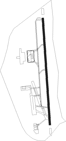
Mendoza - El Plumerillo
Airport details
| Country | Argentina |
| State | Mendoza |
| Region | SA |
| Airspace | Mendoza Ctr |
| Municipality | Departamento Las Heras |
| Elevation | 2310ft (704m) |
| Timezone | GMT -3 |
| Coordinates | -32.83710, -68.79781 |
| Magnetic var | |
| Type | land |
| Available since | X-Plane v10.40 |
| ICAO code | SAME |
| IATA code | MDZ |
| FAA code | n/a |
Communication
| El Plumerillo ATIS | 127.600 |
| El Plumerillo Ground Control | 121.950 |
| El Plumerillo Tower | 119.900 |
| El Plumerillo DepartureARTURE | 119.900 |
Approach frequencies
| ILS-cat-I | RW36 | 109.9 | 18.00mi |
| 3° GS | RW36 | 109.9 | 18.00mi |
Nearby Points of Interest:
Plaza Pedro del Castillo
-Gómez Building
-Villavicnecio Natural Reserve
Nearby beacons
| code | identifier | dist | bearing | frequency |
|---|---|---|---|---|
| DOZ | MENDOZA VOR/DME | 0.4 | 53° | 114.90 |
| D | EL PLUMERILLO (MENDOZA) NDB | 1.1 | 164° | 395 |
Departure and arrival routes
| Transition altitude | 6000ft |
| SID end points | distance | outbound heading | |
|---|---|---|---|
| RW18 | |||
| MEBR1E, MEBR1G | 52mi | 31° | |
| SALB1G, SALB1E | 55mi | 72° | |
| KAMU1E, KAMU1G | 55mi | 94° | |
| PAPI1G, PAPI1E | 55mi | 105° | |
| DOSL1G, DOSL1E | 55mi | 116° | |
| ESIT1G, ESIT1E | 64mi | 184° | |
| UMKA1G, UMKA1E | 61mi | 268° | |
| RW36 | |||
| MEBR1C, MEBR1A | 52mi | 31° | |
| SALB1C, SALB1A | 55mi | 72° | |
| KAMU1C, KAMU1A | 55mi | 94° | |
| PAPI1A, PAPI1C | 55mi | 105° | |
| DOSL1C, DOSL1A | 55mi | 116° | |
| ESIT1C, ESIT1A | 64mi | 184° | |
| UMKA1A, UMKA1C | 61mi | 268° | |
| STAR starting points | distance | inbound heading | |
|---|---|---|---|
| RW18 | |||
| ESIT1U | 63.8 | 4° | |
| NEBE1U | 80.0 | 49° | |
| MEBR1U | 52.2 | 211° | |
| SALB1U | 55.4 | 252° | |
| PAPI1U | 55.2 | 285° | |
| ANLI1U | 83.6 | 296° | |
| RW36 | |||
| ESIT1Q | 63.8 | 4° | |
| NEBE1Q | 80.0 | 49° | |
| MEBR2Q | 52.2 | 211° | |
| SALB2Q | 55.4 | 252° | |
| PAPI2Q | 55.2 | 285° | |
| DOSL2Q | 55.1 | 296° | |
Instrument approach procedures
| runway | airway (heading) | route (dist, bearing) |
|---|---|---|
| RW18 | SIREK (211°) | SIREK 6000ft LOMAD (7mi, 250°) 4500ft |
| RNAV | LOMAD 4500ft VAROR (5mi, 181°) 3900ft SAME (6mi, 184°) 2340ft ME304 (3mi, 175°) SUCUA (11mi, 101°) 6000ft SUCUA (turn) 6000ft | |
| RW36 | KEXEV (360°) | KEXEV 6000ft ILTUH (4mi, 1°) 5500ft |
| RW36 | MUBEN (320°) | MUBEN ILTUH (9mi, 271°) 5500ft |
| RNAV | ILTUH 5500ft TODAR (7mi, 1°) 4000ft ME041 (3mi, 1°) 3140ft SAME (3mi, 355°) 2360ft ME969 (4mi, 4°) UKLIK (17mi, 65°) 5700ft UKLIK (turn) 6000ft |
Holding patterns
| STAR name | hold at | type | turn | heading* | altitude | leg | speed limit |
|---|---|---|---|---|---|---|---|
| ANLI1U | SIREK | VHF | right | 84 (264)° | > 6000ft | DME 4.0mi | 210 |
| DOSL2Q | MUBEN | VHF | right | 96 (276)° | > 7500ft | DME 4.0mi | 220 |
| ESIT1U | SIREK | VHF | right | 84 (264)° | > 6000ft | DME 4.0mi | 210 |
| MEBR1U | SIREK | VHF | right | 84 (264)° | > 6000ft | DME 4.0mi | 210 |
| MEBR2Q | MUBEN | VHF | right | 96 (276)° | > 7500ft | DME 4.0mi | 220 |
| NEBE1U | SIREK | VHF | right | 84 (264)° | > 6000ft | DME 4.0mi | 210 |
| PAPI1U | SIREK | VHF | right | 84 (264)° | > 6000ft | DME 4.0mi | 210 |
| PAPI2Q | MUBEN | VHF | right | 96 (276)° | > 7500ft | DME 4.0mi | 220 |
| SALB1U | SIREK | VHF | right | 84 (264)° | > 6000ft | DME 4.0mi | 210 |
| SALB2Q | MUBEN | VHF | right | 96 (276)° | > 7500ft | DME 4.0mi | 220 |
| *) magnetic outbound (inbound) holding course | |||||||
Disclaimer
The information on this website is not for real aviation. Use this data with the X-Plane flight simulator only! Data taken with kind consent from X-Plane 12 source code and data files. Content is subject to change without notice.