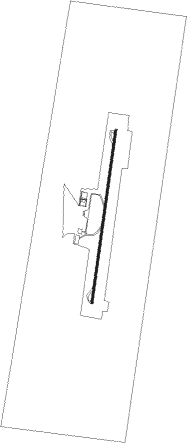
Catamarca - Coronel Felipe Varela - Catamarca
Airport details
| Country | Argentina |
| State | Catamarca |
| Region | SA |
| Airspace | Cordoba Ctr |
| Municipality | Valle Viejo Department |
| Elevation | 1520ft (463m) |
| Timezone | GMT -3 |
| Coordinates | -28.59306, -65.75111 |
| Magnetic var | |
| Type | land |
| Available since | X-Plane v10.40 |
| ICAO code | SANC |
| IATA code | CTC |
| FAA code | n/a |
Communication
| Coronel Felipe Varela - Catamarca Tower | 118.150 |
Runway info
| Runway 02 / 20 | ||
| length | 2805m (9203ft) | |
| bearing | 14° / 194° | |
| width | 30m (98ft) | |
| surface | asphalt | |
| blast zone | 23m (75ft) / 22m (72ft) | |
Nearby beacons
| code | identifier | dist | bearing | frequency |
|---|---|---|---|---|
| CAT | CATAMARCA VOR/DME | 0.6 | 25° | 114.30 |
Departure and arrival routes
| Transition altitude | 8000ft |
| SID end points | distance | outbound heading | |
|---|---|---|---|
| RW02 | |||
| SORT1C, SORT1A | 55mi | 20° | |
| LITO1C, LITO1A | 30mi | 150° | |
| KAKA1C, KAKA1A | 43mi | 233° | |
| RW20 | |||
| SORT1E, SORT1G | 55mi | 20° | |
| LITO1E, LITO1G | 30mi | 150° | |
| KAKA1E, KAKA1G | 43mi | 233° | |
| STAR starting points | distance | inbound heading | |
|---|---|---|---|
| RW02 | |||
| KAKA1M | 43.0 | 53° | |
| SORT1M | 55.2 | 200° | |
| ITEL1M | 29.7 | 317° | |
| LITO1M | 29.6 | 330° | |
| RW20 | |||
| KAKA1Q | 43.0 | 53° | |
| SORT1Q | 55.2 | 200° | |
| ITEL1Q | 29.7 | 317° | |
| LITO1Q | 29.6 | 330° | |
Instrument approach procedures
| runway | airway (heading) | route (dist, bearing) |
|---|---|---|
| RW02 | BRANC (14°) | BRANC 6000ft NC023 (7mi, 14°) 4300ft RAFRO (5mi, 14°) 3200ft |
| RNAV | RAFRO 3200ft ESUBI (5mi, 14°) 3160ft SANC (6mi, 14°) 1558ft NC025 (4mi, 13°) 2600ft GELEX (5mi, 240°) 4200ft BRANC (24mi, 184°) 6000ft BRANC (turn) 6000ft | |
| RW20 | ENVOK (193°) | ENVOK 8000ft AMIAS (6mi, 193°) 6000ft |
| RNAV | AMIAS 6000ft NC203 (3mi, 193°) 5200ft NC202 (3mi, 193°) 4700ft TINLU (6mi, 193°) 3520ft NC025 (3mi, 194°) 2720ft SANC (4mi, 193°) 1606ft BRANC (23mi, 194°) 6000ft BRANC (turn) 6000ft |
Holding patterns
| STAR name | hold at | type | turn | heading* | altitude | leg | speed limit |
|---|---|---|---|---|---|---|---|
| ITEL1M | BRANC | VHF | left | 197 (17)° | DME 4.0mi | 210 | |
| ITEL1Q | ENVOK | VHF | left | 18 (198)° | DME 4.0mi | 210 | |
| KAKA1M | BRANC | VHF | left | 197 (17)° | DME 4.0mi | 210 | |
| KAKA1Q | ENVOK | VHF | left | 18 (198)° | DME 4.0mi | 210 | |
| LITO1M | BRANC | VHF | left | 197 (17)° | DME 4.0mi | 210 | |
| LITO1Q | ENVOK | VHF | left | 18 (198)° | DME 4.0mi | 210 | |
| SORT1M | BRANC | VHF | left | 197 (17)° | DME 4.0mi | 210 | |
| SORT1Q | ENVOK | VHF | left | 18 (198)° | DME 4.0mi | 210 | |
| *) magnetic outbound (inbound) holding course | |||||||
Disclaimer
The information on this website is not for real aviation. Use this data with the X-Plane flight simulator only! Data taken with kind consent from X-Plane 12 source code and data files. Content is subject to change without notice.
