Santiago Del Estero - Vicecomodoro Angel D. La Paz Aragones
Airport details
| Country | Argentina |
| State | Santiago del Estero |
| Region | SA |
| Airspace | Cordoba Ctr |
| Municipality | Municipio de Santiago del Estero |
| Elevation | 654ft (199m) |
| Timezone | GMT -3 |
| Coordinates | -27.75965, -64.29988 |
| Magnetic var | |
| Type | land |
| Available since | X-Plane v10.40 |
| ICAO code | SANE |
| IATA code | SDE |
| FAA code | n/a |
Communication
| Vicecomodoro Angel D. La Paz Aragones Tower | 118.700 |
Runway info
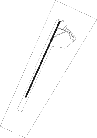
| Runway 03 / 21 | ||
| length | 2429m (7969ft) | |
| bearing | 32° / 212° | |
| width | 45m (148ft) | |
| surface | asphalt | |
| displ threshold | 200m (656ft) / 309m (1014ft) | |
Nearby beacons
| code | identifier | dist | bearing | frequency |
|---|---|---|---|---|
| SDE | SANTIAGO DEL ESTERO VOR | 1.5 | 223° | 114.80 |
| D | VCOM ANGEL D. LA PAZ ARAGONEZ NDB | 1.8 | 221° | 330 |
| TRH | TERMAS DE RIO HONDO VOR/DME | 37.2 | 293° | 113.70 |
| TUC | TUCUMAN VOR/DME | 69.8 | 319° | 114.10 |
Departure and arrival routes
| Transition altitude | 3000ft |
| SID end points | distance | outbound heading | |
|---|---|---|---|
| RW03 | |||
| DIKO1G | 31mi | 164° | |
| VUPR1G | 31mi | 180° | |
| PUBE1G | 23mi | 303° | |
| ANGE1G | 30mi | 324° | |
| RW21 | |||
| DIKO1C | 31mi | 164° | |
| VUPR1C | 31mi | 180° | |
| PUBE1C | 23mi | 303° | |
| ANGE1C | 30mi | 324° | |
Instrument approach procedures
| runway | airway (heading) | route (dist, bearing) |
|---|---|---|
| RW03 | LOKAV (6°) | LOKAV 3000ft TIRDU (5mi, 295°) 2300ft |
| RW03 | MEXUB (56°) | MEXUB 4000ft TIRDU (5mi, 115°) 2300ft |
| RNAV | TIRDU 2300ft DAGIG (5mi, 31°) 2300ft NE031 (2mi, 31°) 1670ft SANE (4mi, 35°) 703ft NE947 (2mi, 20°) LOKAV (14mi, 188°) 3000ft LOKAV (turn) 3000ft | |
| RW21 | GELUV (185°) | GELUV 4000ft PUGEK (5mi, 134°) 2300ft |
| RW21 | VUMER (231°) | VUMER 3000ft PUGEK (5mi, 277°) 2300ft |
| RNAV | PUGEK 2300ft MOLRI (5mi, 211°) 2300ft SANE (5mi, 207°) 704ft NE865 (3mi, 217°) VUMER (15mi, 49°) 3000ft VUMER (turn) 3000ft |
Disclaimer
The information on this website is not for real aviation. Use this data with the X-Plane flight simulator only! Data taken with kind consent from X-Plane 12 source code and data files. Content is subject to change without notice.