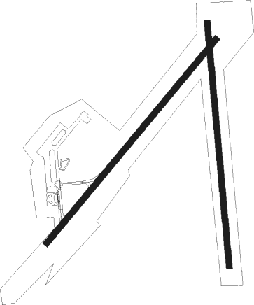
Rio Cuarto - Rio Cuarto - Area Material
Airport details
| Country | Argentina |
| State | Córdoba |
| Region | SA |
| Airspace | Cordoba Ctr |
| Municipality | Pedanía Río Cuarto |
| Elevation | 1376ft (419m) |
| Timezone | GMT -3 |
| Coordinates | -33.09659, -64.27735 |
| Magnetic var | |
| Type | land |
| Available since | X-Plane v10.40 |
| ICAO code | SAOC |
| IATA code | RCU |
| FAA code | n/a |
Communication
| Rio Cuarto - Area Material Approach/Tower | 118.700 |
| Rio Cuarto - Area Material Approach/Tower | 118.750 |
Approach frequencies
| ILS-cat-I | RW05 | 110.9 | 18.00mi |
| 3° GS | RW05 | 110.9 | 18.00mi |
Nearby beacons
| code | identifier | dist | bearing | frequency |
|---|---|---|---|---|
| RCU | RIO CUARTO VOR/DME | 0.6 | 71° | 114.20 |
| R | RIO CUARTO NDB | 0.8 | 222° | 305 |
| SRC | STA. ROSA DE CONLARA(VALL VOR/DME | 63 | 309° | 117.50 |
Instrument approach procedures
| runway | airway (heading) | route (dist, bearing) |
|---|---|---|
| RW05 | DIKOV (354°) | DIKOV IROKA (12mi, 309°) 3000ft |
| RW05 | LOKAT (78°) | LOKAT IROKA (12mi, 100°) 3000ft |
| RW05 | VURTA (60°) | VURTA IROKA (12mi, 68°) 3000ft |
| RNAV | IROKA 3000ft KEXUS (5mi, 49°) 3000ft OC002 (3mi, 49°) 2200ft SAOC (3mi, 47°) 1429ft OC731 (3mi, 51°) GELOS (15mi, 95°) GELOS (turn) | |
| RW23 | EGOPA (218°) | EGOPA ALOTE (12mi, 206°) 3000ft |
| RW23 | GELOS (268°) | GELOS ALOTE (12mi, 303°) 3000ft |
| RW23 | ILSOK (177°) | ILSOK ALOTE (12mi, 129°) 3000ft |
| RNAV | ALOTE 3000ft OSIDO (5mi, 229°) 3000ft SAOC (6mi, 230°) 1427ft OC732 (2mi, 226°) DIKOV (14mi, 167°) DIKOV (turn) |
Disclaimer
The information on this website is not for real aviation. Use this data with the X-Plane flight simulator only! Data taken with kind consent from X-Plane 12 source code and data files. Content is subject to change without notice.

