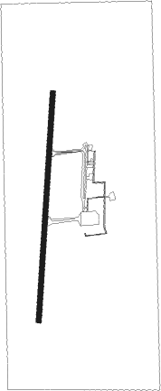
Corrientes
Airport details
| Country | Argentina |
| State | Corrientes |
| Region | SA |
| Airspace | Resistencia Ctr |
| Elevation | 203ft (62m) |
| Timezone | GMT -3 |
| Coordinates | -27.44472, -58.76167 |
| Magnetic var | |
| Type | land |
| Available since | X-Plane v10.40 |
| ICAO code | SARC |
| IATA code | CNQ |
| FAA code | n/a |
Communication
| Corrientes Ground Control | 121.750 |
| Corrientes Tower | 118.300 |
Approach frequencies
| ILS-cat-I | RW20 | 109.7 | 18.00mi |
| 3° GS | RW20 | 109.7 | 18.00mi |
Nearby beacons
| code | identifier | dist | bearing | frequency |
|---|---|---|---|---|
| CRS | CORRIENTES VOR/DME | 0.4 | 359° | 115.40 |
| C | CORRIENTES NDB | 1 | 10° | 305 |
| OC | CORRIENTES NDB | 4.5 | 184° | 330 |
| N | RESISTENCIA NDB | 15.1 | 274° | 262 |
| SIS | RESISTENCIA VOR/DME | 15.7 | 270° | 115.10 |
Departure and arrival routes
| Transition altitude | 3000ft |
| SID end points | distance | outbound heading | |
|---|---|---|---|
| RW02 | |||
| BOBI1K | 21mi | 53° | |
| LUTS1K | 39mi | 89° | |
| KILI1K | 134mi | 183° | |
| OPKA1K | 62mi | 214° | |
| ESMO1K | 68mi | 238° | |
| GUKA1K | 71mi | 273° | |
| PANO1K | 69mi | 290° | |
| DOPL1K | 187mi | 321° | |
| AKPE1K | 154mi | 339° | |
| DIGE1K | 26mi | 359° | |
| RW20 | |||
| BOBI1M | 21mi | 53° | |
| LUTS1M | 39mi | 89° | |
| KILI1M | 134mi | 183° | |
| OPKA1M | 62mi | 214° | |
| ESMO1M | 68mi | 238° | |
| GUKA1M | 71mi | 273° | |
| PANO1M | 69mi | 290° | |
| DOPL1M | 187mi | 321° | |
| AKPE1M | 154mi | 339° | |
| STAR starting points | distance | inbound heading | |
|---|---|---|---|
| RW02 | |||
| KILI1Z | 134.3 | 3° | |
| OPKA1Z | 62.1 | 34° | |
| ESMO1Z | 67.5 | 58° | |
| GUKA1Z | 70.9 | 93° | |
| PANO1Z | 69.2 | 110° | |
| DOPL1Z | 186.8 | 141° | |
| AKPE1Z | 153.5 | 159° | |
| SOSN1Z | 51.3 | 186° | |
| BOBI1Z | 21.4 | 233° | |
| LUTS1Z | 39.2 | 269° | |
| RW20 | |||
| KILI1V | 134.3 | 3° | |
| OPKA1V | 62.1 | 34° | |
| ESMO1V | 67.5 | 58° | |
| GUKA1V, GUKA1Y | 70.9 | 93° | |
| PANO1V | 69.2 | 110° | |
| DOPL1V | 186.8 | 141° | |
| AKPE1V | 153.5 | 159° | |
| DIGE1V | 25.6 | 179° | |
| BOBI1V, BOBI1Y | 21.4 | 233° | |
| LUTS1V, LUTS1Y | 39.2 | 269° | |
Instrument approach procedures
| runway | airway (heading) | route (dist, bearing) |
|---|---|---|
| RW02 | ESLOD (9°) | ESLOD 3000ft USAVO (6mi, 9°) 2000ft |
| RW02 | PUKIK (336°) | PUKIK 3000ft USAVO (6mi, 277°) 2000ft |
| RNAV | USAVO 2000ft KEXOS (5mi, 9°) 2000ft SARC (6mi, 9°) 254ft RC003 (4mi, 9°) UGASI (24mi, 132°) 3000ft UGASI (turn) 3000ft | |
| RW20 | ILPES (225°) | ILPES 3000ft NUXAS (10mi, 259°) 2000ft |
| RW20 | MORPU (162°) | MORPU 3000ft NUXAS (6mi, 115°) 2000ft |
| RW20 | TIMKO (189°) | TIMKO 3000ft NUXAS (6mi, 189°) 2000ft |
| RNAV | NUXAS 2000ft EPDIL (5mi, 189°) 2000ft SARC (6mi, 189°) 251ft RC008 (6mi, 189°) ILPES (22mi, 37°) 3000ft ILPES (turn) 3000ft |
Holding patterns
| STAR name | hold at | type | turn | heading* | altitude | leg | speed limit |
|---|---|---|---|---|---|---|---|
| AKPE1Z | SULBO | VHF | right | 310 (130)° | > 3000ft | DME 4.0mi | 210 |
| BOBI1Z | UGASI | VHF | left | 93 (273)° | > 3000ft | DME 4.0mi | 210 |
| DIGE1V | DIGET | VHF | right | 56 (236)° | > 5000ft | DME 4.0mi | 210 |
| DOPL1Z | SULBO | VHF | right | 310 (130)° | > 3000ft | DME 4.0mi | 210 |
| ESMO1V | MAMPU | VHF | left | 216 (36)° | > 11000ft | DME 4.0mi | 220 |
| GUKA1Y | MAMPU | VHF | left | 216 (36)° | > 11000ft | DME 4.0mi | 220 |
| GUKA1Z | SULBO | VHF | right | 310 (130)° | > 3000ft | DME 4.0mi | 210 |
| KILI1V | BURSA | VHF | left | 188 (8)° | > 8000ft | DME 4.0mi | 220 |
| KILI1Z | BURSA | VHF | left | 188 (8)° | > 8000ft | DME 4.0mi | 220 |
| LUTS1Z | UGASI | VHF | left | 93 (273)° | > 3000ft | DME 4.0mi | 210 |
| PANO1Z | SULBO | VHF | right | 310 (130)° | > 3000ft | DME 4.0mi | 210 |
| SOSN1Z | SULBO | VHF | right | 310 (130)° | > 3000ft | DME 4.0mi | 210 |
| *) magnetic outbound (inbound) holding course | |||||||
Disclaimer
The information on this website is not for real aviation. Use this data with the X-Plane flight simulator only! Data taken with kind consent from X-Plane 12 source code and data files. Content is subject to change without notice.
