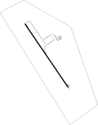
San Salvador De Jujuy - Gobernador Horacio Guzmán - Jujuy
Airport details
| Country | Argentina |
| State | Jujuy |
| Region | SA |
| Airspace | Cordoba Ctr |
| Municipality | Municipio de Perico |
| Elevation | 3019ft (920m) |
| Timezone | GMT -3 |
| Coordinates | -24.39278, -65.09778 |
| Magnetic var | |
| Type | land |
| Available since | X-Plane v10.40 |
| ICAO code | SASJ |
| IATA code | JUJ |
| FAA code | n/a |
Communication
| Gobernador Horacio Guzmán - Jujuy Tower | 118.700 |
Approach frequencies
| ILS-cat-I | RW34 | 110.1 | 18.00mi |
| 3° GS | RW34 | 110.1 | 18.00mi |
Nearby beacons
| code | identifier | dist | bearing | frequency |
|---|---|---|---|---|
| JUJ | JUJUY VOR/DME | 0.2 | 98° | 112.90 |
| OJ | GOBERNADOR HORACIO GUZMAN NDB | 4.6 | 148° | 315 |
| SAL | SALTA VOR/DME | 34.7 | 220° | 116.70 |
| L | GEN. DON MARTIN MIGUEL DE GUEM NDB | 35.7 | 220° | 305 |
Departure and arrival routes
| Transition altitude | 9000ft |
| SID end points | distance | outbound heading | |
|---|---|---|---|
| RW16 | |||
| MOXA1G, MOXA1E | 20mi | 32° | |
| MIME1G | 29mi | 98° | |
| KOVA1E | 36mi | 98° | |
| TEGA1G, TEGA1E | 58mi | 147° | |
| ASOD1G, ASOD1E | 115mi | 151° | |
| PONP1E, PONP1G | 83mi | 189° | |
| SA661G | 33mi | 201° | |
| ALGA1G | 99mi | 215° | |
| RW34 | |||
| MOXA1C, MOXA1A | 20mi | 32° | |
| KOVA1A, KOVA1C | 36mi | 98° | |
| TEGA1C, TEGA1A | 58mi | 147° | |
| ASOD1C, ASOD1A | 115mi | 151° | |
| PONP1A, PONP1C | 83mi | 189° | |
| SA661C | 33mi | 201° | |
| ALGA1C | 99mi | 215° | |
| STAR starting points | distance | inbound heading | |
|---|---|---|---|
| RW16 | |||
| ALGA1U | 98.6 | 35° | |
| MOXA1U | 20.1 | 212° | |
| KOVA1U | 35.7 | 278° | |
| TEGA1U | 57.7 | 327° | |
| ASOD1U | 115.2 | 331° | |
| ILPA1U | 78.4 | 360° | |
| RW34 | |||
| ALGA1Q | 98.6 | 35° | |
| MOXA1P, MOXA1Q | 20.1 | 212° | |
| KOVA1P, KOVA1Q | 35.7 | 278° | |
| TEGA1Q | 57.7 | 327° | |
| ASOD1Q, ASOD1P | 115.2 | 331° | |
| ILPA1S, ILPA1Q, ILPA1P | 78.4 | 360° | |
Instrument approach procedures
| runway | airway (heading) | route (dist, bearing) |
|---|---|---|
| RW16 | SISEV (97°) | SISEV 8200ft SJ059 (8mi, 342°) SJ060 (2mi, 3°) SJ061 (4mi, 78°) 8200ft SJ062 (5mi, 118°) 6800ft SJ063 (1mi, 127°) 6300ft PUBTI (2mi, 127°) 5400ft |
| RNAV | PUBTI 5400ft SJ065 (2mi, 148°) 4900ft PANUX (2mi, 148°) 4900ft SJ067 (3mi, 148°) 4020ft SJ068 (turn) 3660ft SASJ (2mi, 148°) 3070ft SJ069 (4mi, 148°) SJ070 (12mi, 148°) SJ071 (10mi, 62°) OGNAX (11mi, 328°) 9000ft OGNAX (turn) 9000ft | |
| RW34 | GIGPO (351°) | GIGPO 7000ft LUVLA (6mi, 62°) 5600ft |
| RW34 | MUNON (306°) | MUNON 7000ft LUVLA (6mi, 242°) 5600ft |
| RW34 | SULVU (331°) | SULVU 7300ft LUVLA (5mi, 339°) 5600ft |
| RNAV | LUVLA 5600ft ASBEL (6mi, 328°) 5600ft SASJ (9mi, 328°) 2954ft SJ210 (8mi, 328°) 5300ft SJ398 (6mi, 302°) 6100ft JUJ (14mi, 136°) 9200ft JUJ (turn) |
Holding patterns
| STAR name | hold at | type | turn | heading* | altitude | leg | speed limit |
|---|---|---|---|---|---|---|---|
| ASOD1U | SJ282 | VHF | left | 158 (338)° | > 10000ft | DME 4.0mi | 220 |
| ILPA1U | ILPAR | VHF | right | 188 (8)° | > 15000ft | DME 7.0mi | 240 |
| KOVA1U | MIMEX | VHF | right | 107 (287)° | > 13000ft | DME 4.0mi | 220 |
| MOXA1Q | OGNAX | VHF | left | 4 (184)° | > 9000ft | DME 4.0mi | 220 |
| MOXA1U | OGNAX | VHF | left | 4 (184)° | > 9000ft | DME 4.0mi | 220 |
| *) magnetic outbound (inbound) holding course | |||||||
Disclaimer
The information on this website is not for real aviation. Use this data with the X-Plane flight simulator only! Data taken with kind consent from X-Plane 12 source code and data files. Content is subject to change without notice.
