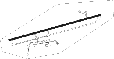
Comodoro Rivadavia
Airport details
| Country | Argentina |
| State | Chubut Province |
| Region | SA |
| Airspace | Comodoro Rivadavia Ctr |
| Municipality | Comodoro Rivadavia |
| Elevation | 188ft (57m) |
| Timezone | GMT -3 |
| Coordinates | -45.78528, -67.46555 |
| Magnetic var | |
| Type | land |
| Available since | X-Plane v10.40 |
| ICAO code | SAVC |
| IATA code | CRD |
| FAA code | n/a |
Communication
| Comodoro Rivadavia Tower | 119.900 |
| Comodoro Rivadavia Approach | 124.300 |
Approach frequencies
| ILS-cat-I | RW25 | 110.3 | 18.00mi |
| 3° GS | RW25 | 110.3 | 18.00mi |
Runway info
| Runway 07 / 25 | ||
| length | 2871m (9419ft) | |
| bearing | 82° / 262° | |
| width | 50m (164ft) | |
| surface | asphalt | |
| blast zone | 150m (492ft) / 250m (820ft) | |
Nearby beacons
| code | identifier | dist | bearing | frequency |
|---|---|---|---|---|
| C | GEN ENRIQUE MOSCONI(COMODORO R NDB | 1.3 | 82° | 280 |
| OC | GEN ENRIQUE MOSCONI(COMODORO R NDB | 3.9 | 82° | 260 |
| CRV | COMODORO RIVADAVIA VOR/DME | 4 | 83° | 117.50 |
Departure and arrival routes
| Transition altitude | 3000ft |
| SID end points | distance | outbound heading | |
|---|---|---|---|
| RW07 | |||
| GATU1C | 127mi | 42° | |
| BODU1C | 54mi | 191° | |
| GILV1C | 53mi | 220° | |
| ETAS1C | 51mi | 268° | |
| VUKN1C | 53mi | 310° | |
| EGEG1C | 54mi | 323° | |
| PUBL1C | 119mi | 356° | |
| RW25 | |||
| GATU1G | 127mi | 42° | |
| BODU1G | 54mi | 191° | |
| GILV1G | 53mi | 220° | |
| ETAS1G | 51mi | 268° | |
| VUKN1G | 53mi | 310° | |
| EGEG1G | 54mi | 323° | |
| PUBL1G | 119mi | 356° | |
| STAR starting points | distance | inbound heading | |
|---|---|---|---|
| RW07 | |||
| BODU1Q | 53.6 | 11° | |
| GILV1Q | 52.8 | 40° | |
| ETAS1Q | 51.0 | 88° | |
| VUKN1Q | 52.9 | 130° | |
| EGEG1Q | 53.7 | 143° | |
| PUBL1Q | 119.1 | 176° | |
| GATU1Q | 126.8 | 222° | |
| RW25 | |||
| BODU1U | 53.6 | 11° | |
| GILV1U | 52.8 | 40° | |
| ETAS1U | 51.0 | 88° | |
| VUKN1U | 52.9 | 130° | |
| EGEG1U | 53.7 | 143° | |
| PUBL1U | 119.1 | 176° | |
| GATU1U | 126.8 | 222° | |
Instrument approach procedures
| runway | airway (heading) | route (dist, bearing) |
|---|---|---|
| RW07 | ASBUN (63°) | ASBUN 3700ft ORIBI (6mi, 346°) 3300ft |
| RW07 | GUXON (101°) | GUXON 3700ft ORIBI (6mi, 166°) 3300ft |
| RW07 | PRETA (83°) | PRETA 3700ft ORIBI (6mi, 83°) 3300ft |
| RNAV | ORIBI 3300ft VC901 (2mi, 83°) 2700ft VULNU (3mi, 83°) 2700ft VC902 (3mi, 83°) 1810ft VC999 (1mi, 83°) 1380ft SAVC (4mi, 83°) 211ft VC076 (6mi, 82°) VC077 (5mi, 165°) ASBUN (18mi, 261°) 3700ft ASBUN (turn) 3700ft | |
| RW25-Y | ESLUN (250°) | ESLUN 3000ft KABIT (6mi, 218°) 2000ft |
| RW25-Y | VUNIL (278°) | VUNIL 3000ft KABIT (6mi, 319°) 2000ft |
| RNAV | KABIT 2000ft USOTU (5mi, 262°) 2000ft SAVC (7mi, 262°) 148ft VC301 (5mi, 263°) 2200ft VC307 (6mi, 165°) 3000ft VUNIL (19mi, 82°) 3000ft VUNIL (turn) 3000ft | |
| RW25-Z | ESLUN (250°) | ESLUN 3000ft KABIT (6mi, 218°) 2000ft |
| RW25-Z | VUNIL (278°) | VUNIL 3000ft KABIT (6mi, 319°) 2000ft |
| RNAV | KABIT 2000ft USOTU (5mi, 262°) 2000ft SAVC (7mi, 262°) 148ft VC301 (5mi, 263°) 2200ft VC307 (6mi, 165°) 3000ft VUNIL (19mi, 82°) 3000ft VUNIL (turn) 3000ft |
Holding patterns
| STAR name | hold at | type | turn | heading* | altitude | leg | speed limit |
|---|---|---|---|---|---|---|---|
| GATU1Q | SININ | VHF | right | 26 (206)° | DME 4.0mi | 210 | |
| GATU1U | GEVLU | VHF | left | 23 (203)° | > 3000ft | DME 4.0mi | 210 |
| PUBL1U | GEVLU | VHF | left | 23 (203)° | > 3000ft | DME 4.0mi | 210 |
| *) magnetic outbound (inbound) holding course | |||||||
Disclaimer
The information on this website is not for real aviation. Use this data with the X-Plane flight simulator only! Data taken with kind consent from X-Plane 12 source code and data files. Content is subject to change without notice.
