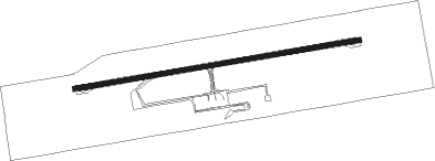
El Calafate
Airport details
| Country | Argentina |
| State | Santa Cruz Province |
| Region | SA |
| Airspace | Comodoro Rivadavia Ctr |
| Municipality | Lago Argentino |
| Elevation | 666ft (203m) |
| Timezone | GMT -3 |
| Coordinates | -50.28028, -72.05334 |
| Magnetic var | |
| Type | land |
| Available since | X-Plane v10.40 |
| ICAO code | SAWC |
| IATA code | FTE |
| FAA code | n/a |
Communication
| El Calafate Ground Control | 121.800 |
| El Calafate Tower | 119.950 |
Approach frequencies
| ILS-cat-I | RW25 | 108.9 | 18.00mi |
| 3° GS | RW25 | 108.9 | 18.00mi |
Nearby beacons
| code | identifier | dist | bearing | frequency |
|---|---|---|---|---|
| ECA | CALAFATE VOR/DME | 0.3 | 77° | 114.70 |
Departure and arrival routes
| Transition altitude | 7000ft |
| SID end points | distance | outbound heading | |
|---|---|---|---|
| RW07 | |||
| OGTU1G | 50mi | 8° | |
| BOKU2G | 135mi | 48° | |
| DEVI1G | 75mi | 116° | |
| KIBA1G | 30mi | 117° | |
| MUNE1G | 107mi | 157° | |
| SULS1G | 31mi | 157° | |
| RW25 | |||
| OGTU1C | 50mi | 8° | |
| BOKU2C | 135mi | 48° | |
| DEVI1C | 75mi | 116° | |
| KIBA1C | 30mi | 117° | |
| MUNE1C | 107mi | 157° | |
| SULS1C | 31mi | 157° | |
| STAR starting points | distance | inbound heading | |
|---|---|---|---|
| RW07 | |||
| OGTU1U | 49.5 | 188° | |
| MOTN1U | 131.6 | 204° | |
| BOKU2U | 135.4 | 228° | |
| ESNA2U | 17.1 | 266° | |
| DEVI1U | 75.3 | 296° | |
| MUNE1U | 107.0 | 337° | |
| RW25 | |||
| ATEX2Q | 15.6 | 87° | |
| OGTU1Q | 49.5 | 188° | |
| MOTN1Q | 131.6 | 204° | |
| BOKU2Q | 135.4 | 228° | |
| DEVI1Q | 75.3 | 296° | |
| MUNE1Q | 107.0 | 337° | |
Instrument approach procedures
| runway | airway (heading) | route (dist, bearing) |
|---|---|---|
| RW07 | ATEXI (87°) | ATEXI 5400ft UKLOV (5mi, 87°) 3300ft |
| RW07 | TORUK (106°) | TORUK 4000ft UKLOV (6mi, 172°) 3300ft |
| RNAV | UKLOV 3300ft TODLO (5mi, 87°) 2290ft WC025 (2mi, 87°) 1660ft SAWC (4mi, 87°) 697ft ESNAM (17mi, 86°) 4600ft ESNAM (turn) 4600ft | |
| RW25 | ATIPO (251°) | ATIPO 4800ft ISAXO (6mi, 203°) 2900ft |
| RW25 | ESNAM (266°) | ESNAM 4600ft ISAXO (6mi, 266°) 2900ft |
| RW25 | PONRO (282°) | PONRO 4900ft WC100 (2mi, 324°) 4200ft ISAXO (4mi, 324°) 2900ft |
| RNAV | ISAXO 2900ft VUSDO (4mi, 266°) 2900ft SAWC (8mi, 267°) 681ft WC803 (4mi, 267°) ATEXI (12mi, 267°) 5400ft ATEXI (turn) 5400ft |
Holding patterns
| STAR name | hold at | type | turn | heading* | altitude | leg | speed limit |
|---|---|---|---|---|---|---|---|
| BOKU2Q | SARLI | VHF | left | 15 (195)° | > 6000ft | DME 4.0mi | 210 |
| BOKU2U | SARLI | VHF | left | 15 (195)° | > 6000ft | DME 4.0mi | 210 |
| DEVI1Q | MIGUT | VHF | right | 121 (301)° | DME 4.0mi | 210 | |
| DEVI1U | MIGUT | VHF | right | 121 (301)° | DME 4.0mi | 210 | |
| MOTN1Q | SARLI | VHF | left | 15 (195)° | > 6000ft | DME 4.0mi | 210 |
| MOTN1U | SARLI | VHF | left | 15 (195)° | > 6000ft | DME 4.0mi | 210 |
| MUNE1Q | MIGUT | VHF | right | 121 (301)° | DME 4.0mi | 210 | |
| OGTU1Q | SARLI | VHF | left | 15 (195)° | > 6000ft | DME 4.0mi | 210 |
| *) magnetic outbound (inbound) holding course | |||||||
Disclaimer
The information on this website is not for real aviation. Use this data with the X-Plane flight simulator only! Data taken with kind consent from X-Plane 12 source code and data files. Content is subject to change without notice.
