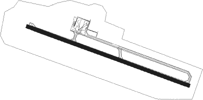
San Carlos De Bariloche
Airport details
| Country | Argentina |
| State | Río Negro Province |
| Region | SA |
| Airspace | Ezeiza Ctr |
| Municipality | Municipio de San Carlos de Bariloche |
| Elevation | 2772ft (845m) |
| Timezone | GMT -3 |
| Coordinates | -41.15111, -71.15778 |
| Magnetic var | |
| Type | land |
| Available since | X-Plane v10.40 |
| ICAO code | SAZS |
| IATA code | BRC |
| FAA code | n/a |
Communication
| San Carlos de Bariloche ATIS | 127.900 |
| San Carlos de Bariloche BARILOCHE Tower/Approach | 119.100 |
| San Carlos de Bariloche BARILOCHE Tower/Approach | 118.650 |
Approach frequencies
| ILS-cat-I | RW29 | 109.5 | 18.00mi |
| 3° GS | RW29 | 109.5 | 18.00mi |
Nearby beacons
| code | identifier | dist | bearing | frequency |
|---|---|---|---|---|
| B | BRAVO (S C DE BARILOCHE) NDB | 1.2 | 289° | 305 |
| BAR | SAN CARLOS DE BARILOCHE VOR/DME | 1.5 | 289° | 117.40 |
| OB | SAN CARLOS DE BARILOCHE NDB | 4.3 | 289° | 330 |
Departure and arrival routes
| Transition altitude | 8000ft |
| SID end points | distance | outbound heading | |
|---|---|---|---|
| RW11 | |||
| ALGI1E, ALGI1G | 36mi | 2° | |
| CHAT1G, CHAT1E | 35mi | 14° | |
| LIMA1E, LIMA1G | 34mi | 53° | |
| ORER1G, ORER1E | 34mi | 76° | |
| PUNO1G, PUNO1E | 34mi | 89° | |
| ATIR1E, ATIR1G | 33mi | 111° | |
| ATAK1G, ATAK1E | 34mi | 144° | |
| TORE1E, TORE1G | 34mi | 180° | |
| TONA1E, TONA1G | 32mi | 263° | |
| RW29 | |||
| ALGI1C, ALGI1A | 36mi | 2° | |
| CHAT1C, CHAT1A | 35mi | 14° | |
| LIMA1C, LIMA1A | 34mi | 53° | |
| ORER1A, ORER1C | 34mi | 76° | |
| PUNO1C, PUNO1A | 34mi | 89° | |
| ATIR1C, ATIR1A | 33mi | 111° | |
| ATAK1A, ATAK1C | 34mi | 144° | |
| TORE1A, TORE1C | 34mi | 180° | |
| TONA1A, TONA1C | 32mi | 263° | |
| STAR starting points | distance | inbound heading | |
|---|---|---|---|
| RW29 | |||
| TORE1Q, TORE1N | 34.3 | 0° | |
| TONA1N, TONA1Q | 31.7 | 83° | |
| ALGI1Q, ALGI1N | 35.6 | 182° | |
| CHAT1Q, CHAT1N | 35.3 | 194° | |
| ORER1N, ORER1Q | 33.8 | 256° | |
| PUNO1N, PUNO1Q | 33.6 | 269° | |
| ATIR1N, ATIR1Q | 33.4 | 291° | |
| ATAK1Q, ATAK1N | 33.7 | 324° | |
Instrument approach procedures
| runway | airway (heading) | route (dist, bearing) |
|---|---|---|
| RW11 | BAR (109°) | BAR ZS305 (12mi, 305°) 6200ft VUDUB (4mi, 212°) 6200ft |
| RNAV | VUDUB 6200ft TEGOP (2mi, 109°) 6200ft SAZS (11mi, 109°) 2789ft ZS104 (7mi, 109°) 4800ft BAR (9mi, 289°) 7700ft BAR (turn) | |
| RW29-Y | BAR (109°) | BAR ZS101 (15mi, 119°) 6200ft PUKIB (3mi, 38°) 6200ft |
| RNAV | PUKIB 6200ft VUKEL (2mi, 289°) 6200ft ZS104 (4mi, 289°) 5000ft ZS105 (3mi, 289°) 3910ft SAZS (4mi, 289°) 2811ft ZS107 (8mi, 289°) 4500ft BAR (6mi, 109°) 8300ft BAR (turn) | |
| RW29-Z | DOGLA (277°) | DOGLA 7300ft PUKIB (5mi, 239°) 6200ft |
| RW29-Z | EKIVO (302°) | EKIVO 7300ft PUKIB (5mi, 348°) 6200ft |
| RW29-Z | ILRAM (289°) | ILRAM 7300ft ZS208 (2mi, 289°) 6500ft PUKIB (turn) 6200ft |
| RNAV | PUKIB 6200ft VUKEL (2mi, 289°) 6200ft ZS104 (4mi, 289°) 5000ft ZS105 (3mi, 289°) 3910ft SAZS (4mi, 289°) 2811ft ZS107 (8mi, 289°) 4500ft BAR (6mi, 109°) 8300ft BAR (turn) |
Holding patterns
| STAR name | hold at | type | turn | heading* | altitude | leg | speed limit |
|---|---|---|---|---|---|---|---|
| ALGI1Q | DOGLA | VHF | left | 45 (225)° | > 7300ft | DME 4.0mi | 220 |
| ATAK1Q | EKIVO | VHF | right | 165 (345)° | > 7300ft | DME 4.0mi | 220 |
| CHAT1Q | DOGLA | VHF | left | 45 (225)° | > 7300ft | DME 4.0mi | 220 |
| ORER1Q | DOGLA | VHF | left | 45 (225)° | > 7300ft | DME 4.0mi | 220 |
| PUNO1Q | DOGLA | VHF | left | 45 (225)° | > 7300ft | DME 4.0mi | 220 |
| TONA1N | BAR | NDB | left | 288 (108)° | > 10000ft | DME 4.0mi | 220 |
| TONA1Q | BAR | NDB | left | 288 (108)° | > 10000ft | DME 4.0mi | 220 |
| TORE1Q | EKIVO | VHF | right | 165 (345)° | > 7300ft | DME 4.0mi | 220 |
| *) magnetic outbound (inbound) holding course | |||||||
Disclaimer
The information on this website is not for real aviation. Use this data with the X-Plane flight simulator only! Data taken with kind consent from X-Plane 12 source code and data files. Content is subject to change without notice.
