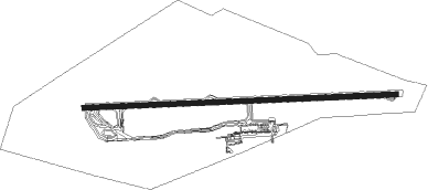
Aracaju - Santa Maria Airport
Airport details
| Country | Brazil |
| State | Sergipe |
| Region | SB |
| Airspace | Recife Ctr |
| Municipality | Aracaju |
| Elevation | 20ft (6m) |
| Timezone | GMT -3 |
| Coordinates | -10.98528, -37.07333 |
| Magnetic var | |
| Type | land |
| Available since | X-Plane v10.40 |
| ICAO code | SBAR |
| IATA code | AJU |
| FAA code | n/a |
Communication
| Santa Maria Airport Tower | 118.800 |
| Santa Maria Airport Approach | 119.000 |
| Santa Maria Airport Approach | 120.300 |
Nearby Points of Interest:
Palacete da Família Rollemberg
-Palácio Inácio Barbosa
-Palácio Fausto Cardoso
-Palácio Olímpio Campos
-Church of Our Lady of the Rosary of Black Men
-São Francisco Square
-Church and Convent of Santa Cruz
-São Cristóvão
-Sobrado à Rua das Flores
-Chapel of Our Lady of the Conception of Engenho Poxim
-Church of Our Lady of the Conception of Comandaroba
-Capela do Engenho Nossa Senhora da Penha
Nearby beacons
| code | identifier | dist | bearing | frequency |
|---|---|---|---|---|
| ARU | CAJU (ARACAJU) VOR/DME | 0.3 | 310° | 115.40 |
Departure and arrival routes
| Transition altitude | 4000ft |
| Transition level | 40ft |
| SID end points | distance | outbound heading | |
|---|---|---|---|
| RW12 | |||
| VUGR1A, ORAG1A, SIMA1A | 50mi | 37° | |
| DEND1A | 58mi | 41° | |
| GATU1A | 75mi | 188° | |
| ATAR1A | 69mi | 204° | |
| RW30 | |||
| ORAG1B | 50mi | 37° | |
| DEND1B | 58mi | 41° | |
| PULU1A | 75mi | 188° | |
| ATAR1B | 69mi | 204° | |
Instrument approach procedures
| runway | airway (heading) | route (dist, bearing) |
|---|---|---|
| RW12-Z | AR361 (116°) | AR361 4000ft AR364 (6mi, 162°) 2500ft |
| RW12-Z | AR362 (92°) | AR362 4000ft AR364 (6mi, 92°) 2500ft |
| RW12-Z | AR363 (68°) | AR363 4000ft AR364 (6mi, 22°) 2500ft |
| RNAV | AR364 2500ft AR366 (5mi, 92°) 1670ft AR003 (3mi, 92°) 742ft SBAR (3mi, 94°) 73ft AR367 (11mi, 92°) 4000ft AR367 (turn) 4000ft | |
| RW30-Y | AR368 (295°) | AR368 4000ft AR367 (6mi, 342°) 2500ft |
| RW30-Y | AR369 (248°) | AR369 4000ft AR367 (6mi, 202°) 2500ft |
| RNAV | AR367 2500ft AR371 (5mi, 272°) 1670ft SBAR (6mi, 271°) 72ft (2309mi, 73°) 2000ft AR369 (2295mi, 254°) 4000ft AR369 (turn) 4000ft |
Disclaimer
The information on this website is not for real aviation. Use this data with the X-Plane flight simulator only! Data taken with kind consent from X-Plane 12 source code and data files. Content is subject to change without notice.