Barbacena - Maj. Brig. Doorgal Borges
Airport details
| Country | Brazil |
| State | Minas Gerais |
| Region | SB |
| Airspace | Curitiba Ctr |
| Municipality | Barbacena |
| Elevation | 3657ft (1115m) |
| Timezone | GMT -3 |
| Coordinates | -21.26417, -43.76278 |
| Magnetic var | |
| Type | land |
| Available since | X-Plane v10.40 |
| ICAO code | SBBQ |
| IATA code | n/a |
| FAA code | n/a |
Communication
| Maj. Brig. Doorgal Borges RDO | 125.900 |
Nearby Points of Interest:
Chapel of Good Jesus of the Poor
-Casa do Padre Toledo
Runway info
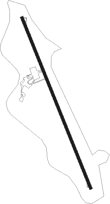
| Runway 18 / 36 | ||
| length | 1758m (5768ft) | |
| bearing | 161° / 341° | |
| width | 30m (98ft) | |
| surface | asphalt | |
Nearby beacons
| code | identifier | dist | bearing | frequency |
|---|---|---|---|---|
| BBC | DME-ILS | 0 | 215° | 111.70 |
| BBC | BARBACENA NDB | 0.1 | 205° | 285 |
| FRA | FORA (JUIZ DE FORA) NDB | 36.9 | 143° |
Departure and arrival routes
| Transition altitude | 7000ft |
| SID end points | distance | outbound heading | |
|---|---|---|---|
| RW18 | |||
| MALP1C | 56mi | 17° | |
| TOKI1C | 46mi | 213° | |
| OPRI1C | 27mi | 326° | |
| RW36 | |||
| MALP1D, MALP1B | 56mi | 17° | |
| TOKI1B, TOKI1D | 46mi | 213° | |
| OGMU1B | 25mi | 225° | |
| KOLT1B | 30mi | 273° | |
| OPRI1B, OPRI1D | 27mi | 326° | |
Instrument approach procedures
| runway | airway (heading) | route (dist, bearing) |
|---|---|---|
| RW18 | BQ004 (162°) | BQ004 6000ft BQ011 (5mi, 162°) 6000ft |
| RW18 | BQ007 (140°) | BQ007 6000ft BQ011 (5mi, 93°) 6000ft |
| RW18 | BQ008 (185°) | BQ008 6000ft BQ011 (5mi, 234°) 6000ft |
| RNAV | BQ011 6000ft BQ012 (5mi, 162°) 5250ft SBBQ (5mi, 162°) 3660ft (2865mi, 64°) 5500ft BQ011 (2864mi, 244°) 6000ft BQ011 (turn) 6000ft | |
| RW36 | BQ021 (3°) | BQ021 6000ft BQ024 (5mi, 54°) 6000ft |
| RW36 | BQ022 (341°) | BQ022 7000ft BQ024 (5mi, 342°) 6000ft |
| RW36 | BQ023 (320°) | BQ023 6000ft BQ024 (5mi, 272°) 6000ft |
| RNAV | BQ024 6000ft BQ026 (5mi, 342°) 5300ft BQ027 (2mi, 342°) 4662ft SBBQ (4mi, 341°) 3707ft (2865mi, 64°) 5500ft BQ024 (2865mi, 244°) 6000ft BQ024 (turn) 6000ft |
Disclaimer
The information on this website is not for real aviation. Use this data with the X-Plane flight simulator only! Data taken with kind consent from X-Plane 12 source code and data files. Content is subject to change without notice.